USA Today published an article yesterday looking at the “flash” drought that is currently occurring in the southern US. If you’ve never heard of the term “flash drought”, then you should know this is a term climatologists use for a drought which comes on very quickly and shows almost immediate impacts to crops and livestock. Flash droughts are most likely to occur when temperatures are high and we go through a dry spell, since the heat and lack of rainfall can quickly degrade soil moisture and stress crops during critical growing periods.
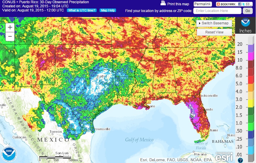
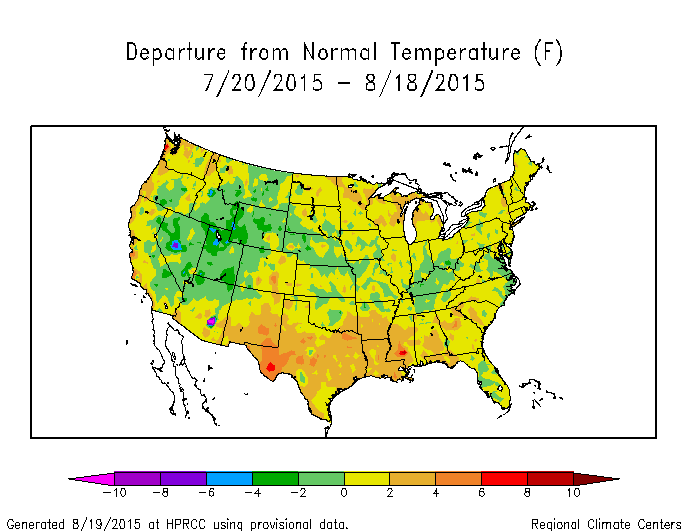
The worst parts of the drought are occurring in Texas. The radar estimated precipitation for the last 30 days is shown below. The area of blue and white is where little to no rain has fallen in the past month. At the same time, the temperature departures in the area are 4-6 degrees above normal. Temperatures are higher in part because there are few clouds in the dry area due to lack of moisture. Temperatures also tend to be higher with dry soils because all of the sun’s energy goes into heating the soil rather than evaporating the water.
The dry conditions are in part a response to the current strong El Nino, which tends to cause late summer dryness in the southern US. Fortunately, it also tends to cause wetter and cooler conditions than normal in the winter months, so some long-term relief is in sight. Whether that comes soon enough to help the farmers is still a big question.