I’ve been getting more and more reports of fires around the driest part of Georgia in the last few weeks. Not surprising considering the exceptional drought that has been expanding from the northwest to other parts of the state (with the except of the southeast, which has been well watered by Hurricanes Hermine and Matthew). If you are going to do a controlled burn, make sure you are in an area that is allowed! In Alabama the governor banned burning in 46 counties there last week (see article here).
You can get more information about fire weather in Georgia from the Georgia Forestry Commission web page at https://weather.gfc.state.ga.us/. You can also get information from the National Weather Service at https://www.srh.noaa.gov/ridge2/fire/.
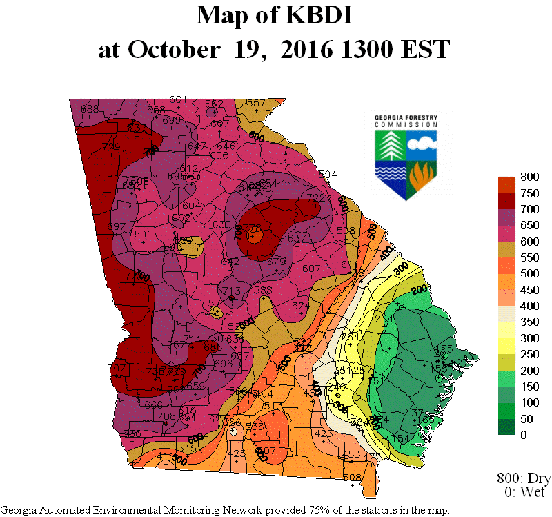
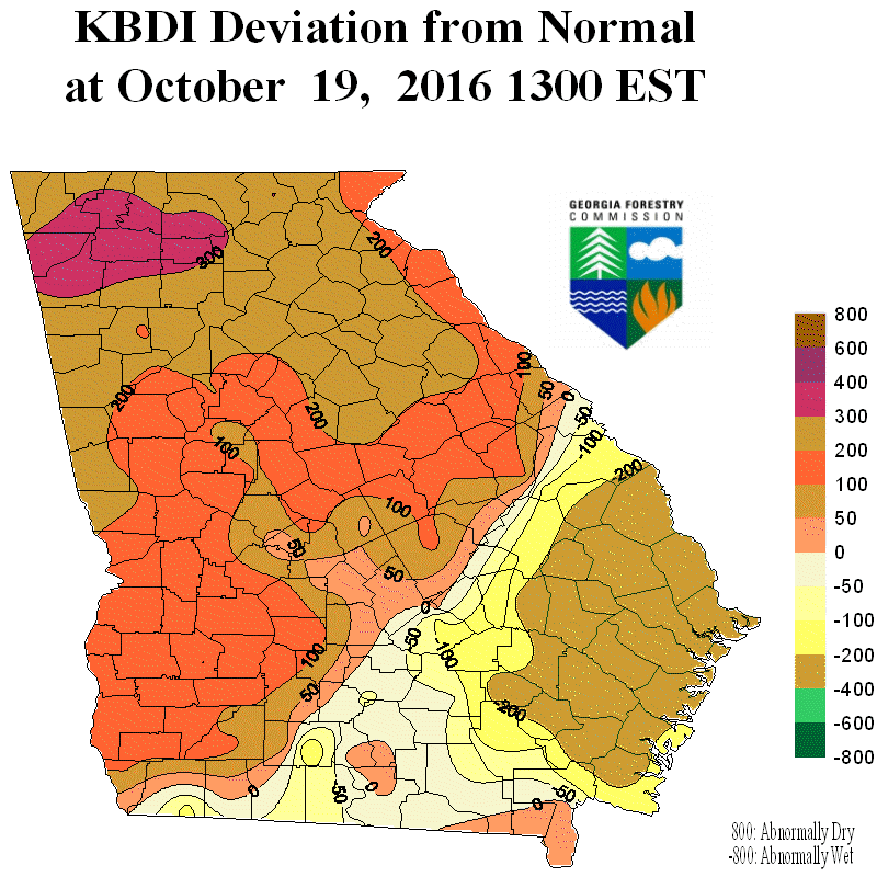
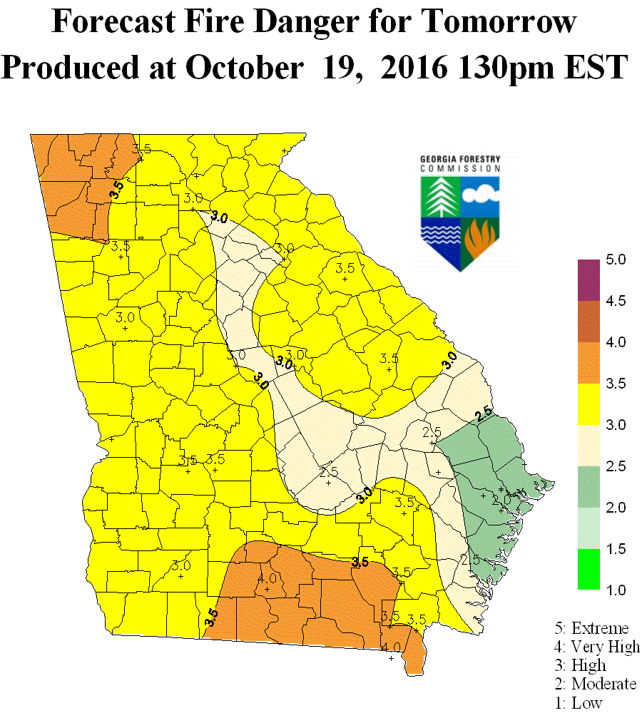
The maps below show the Keetch Byram Drought Index (KBDI) and departure from average plus today’s forecast for fire danger from the Georgia Forestry web site. You can read more about the KBDI at Wikipedia here. Normally a KBDI of 600 or more is considered a severe drought with high fire danger potential.
Florida’s fire weather page is available at https://www.freshfromflorida.com/Divisions-Offices/Florida-Forest-Service/Wildland-Fire/Fire-Weather.