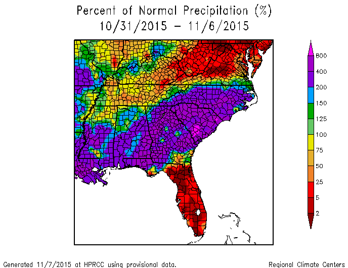
After a wet week in north Georgia and Alabama, many people are eager to get back to drier conditions. The rain has been centered on Alabama, Georgia and the Carolinas; by comparison, if you live in the Florida peninsula you have been almost completely dry and might appreciate some moisture. In Athens GA we are on our 7th day in a row of measurable rainfall–you have to go back to 1930 to find a comparable stretch of November that had rain every day.
The first part of next week also looks like it will be wet, although once the front passes things should clear out a bit in the northern areas. The wettest parts of the Southeast are expected to be along and just off the coasts, where a developing coastal low pressure center is expected to drop more rain in those areas. The wettest time period will be Sunday through Monday, with conditions gradually drying out later in the week.
LATE UPDATE: Predictions for the rain on Monday now show the possibility of widespread 2-4 inch amounts across North Georgia, which would likely include local flooding since soils are already saturated. Temperatures are expected to be in the 40s, which will make for a miserable day, at least for my preferences.
Is this the beginning of the El Nino winter rains? The pattern is certainly similar to what we would expect, but we will have to wait for more persistence in the rainfall before we are confident that the El Nino winter has truly begun.