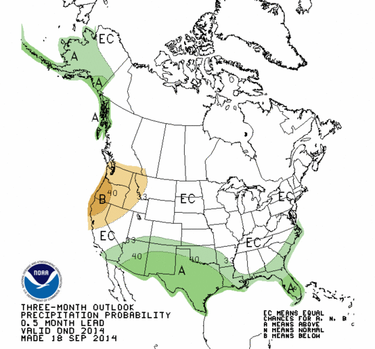
The latest 3-month outlook for the last three months of the year has been released by NOAA’s Climate Prediction Center. It shows an increased chance of above normal temperatures and higher than normal rainfall, particularly in the southern part of the region. The patterns they show are consistent with a developing El Nino, which as been discussed previously in this blog. A recent article from KATC in Louisiana describing the fickle El Nino of 2014 can be found here. However, the pool of warmer than usual water off of Alaska is still there and may alter the usual El Nino patterns. If this pattern is stronger than the weak El Nino patterns, we could still see a colder than normal winter for large parts of the Southeast.