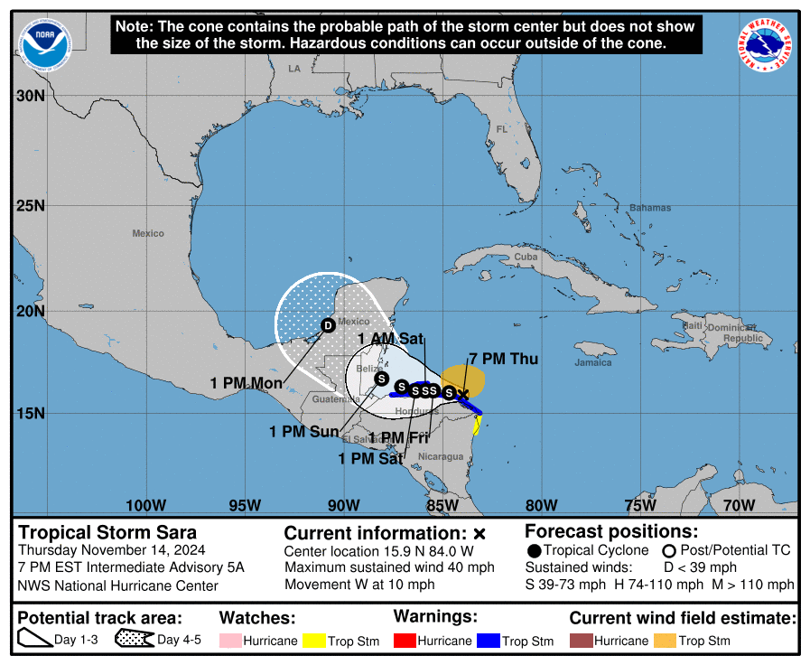
Over the course of the day Potential Tropical Cyclone 19 formed and gradually organized into Tropical Storm Sara. Sara is predicted to move west over Honduras, where it could drop 20 or more inches as it crawls slowly westward into the Yucatan Peninsula and then swings northwest as a weakened storm into the Gulf. A rough rule of thumb for rainfall from tropical cyclones is that if you take 100 divided by the forward speed of the storm in mph, you get an estimate of the total rainfall in inches. Sara is currently moving at 10 mph but is expected to slow down. So if you have a forward speed of 5 mph, then you can expect 100/5=20 inches from the storm. The movement of the storm over mountainous land is expected to significantly disrupt the storm circulation.
Once Sara gets out into the Gulf, it is expected to curve around to the northeast and east. Even though the Gulf is still relatively warm, wind shear is stronger and Sara is not expected to return to hurricane status. However, it will still contain quite a bit of moisture and so areas of north and central Florida and southeast Georgia are currently under a watch for heavy rain around November 19-21 assuming the storm takes the currently forecasted path. If the forecast changes (as it might well considering this is a week out), then the area of heaviest rain will move along with it.