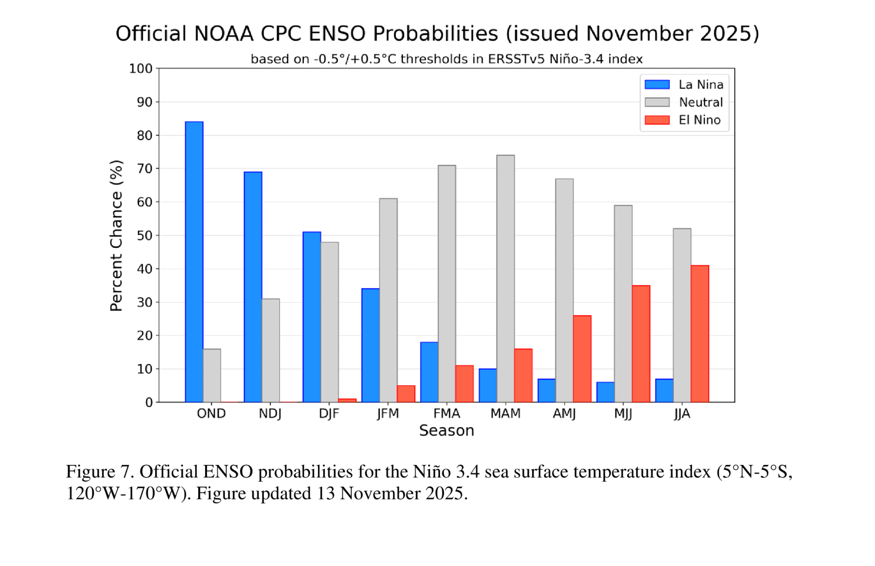
The latest ENSO forecast was released today by NOAA’s Climate Prediction Center. It shows that the current weak La Nina is expected to last through the next few months but is expected to change back to neutral conditions by the January-March period. That is expected to be followed by a relatively rapid swing to La Nina by late in the summer. Since El Nino is associated with strong wind shear aloft, that could mean the development of fewer than usual tropical storms during the next Atlantic hurricane season, although as we know, it only takes one to cause devastation somewhere.
A weak La Nina usually means the warm and dry conditions that we typically see in the Southeast will likely be most noticeable in south Alabama and Georgia and down into Florida and may not make an appearance farther to the north. But cold outbreaks can still occur even in La Nina winters because of other global factors that may be important. Neutral conditions in spring are more likely to lead to late frosts, as well, due to a wavier jet stream that might allow more cold air to surge south like it did last week.
You can read the advisory at https://www.cpc.ncep.noaa.gov/products/analysis_monitoring/enso_advisory/ensodisc.shtml.