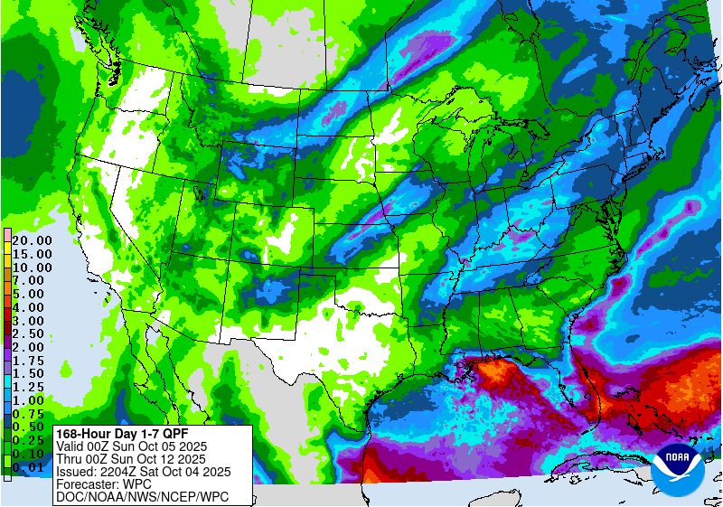
The latest 7-day QPF map shows that rain amounts across most of the region this week are expected to be relatively light. There are two periods during which rain is most likely. The first is the next few days and will be centered on the weak disturbance in the Gulf that is currently causing rain along coastal Louisiana and Mississippi. This disturbance should drift north for the next couple of days and could bring showery weather to areas near it, although the probability of precipitation is less than 50% and is also limited in time.
The second rain-producing event is the movement of a cold front towards our area, bringing a chance of rain to northern parts of the region. Showers could also extend south in mid-week, providing some more unimpressive chances for rain as well as changing the flow and allowing some Gulf moisture to move into the region temporarily. You can see from the map below that the heaviest rain is expected to be along the eastern coast of the Florida Peninsula and right along the northern Gulf Coast, with much lighter amounts expected in most of the Southeast. Unfortunately, there are not really any signs of a change to this weather pattern for the next couple of weeks, although after that a cold front could move into the area, bringing a change in the temperature and some potential rainfall.