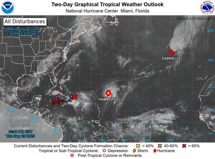
The latest computer models that are trying to predict the development and track of likely Tropical Storm Imelda are showing a track that may bring Imelda and its rains to parts of the East Coast this weekend and early next week. Since the center of development has not consolidated yet, the forecasts are still very uncertain, but the latest ones indicate that a landfall somewhere along the coast of South Carolina is becoming more likely, although there is considerable spread in the array of model tracks. As it approaches the coast and makes landfall, parts of the region could see several inches of rain. The exact amount and location of the heaviest rain will depend on the exact track and forward speed of Imelda but areas from middle Georgia north to North Carolina are likely to see the most rain.
The forecasts will continue to evolve as new information is added to the forecast models, so keep watching for updates and do not take this as the final word. While Imelda is expected to stay a tropical storm, if it slows down over the Gulf Stream it could gain enough energy to become a hurricane before it makes landfall. Humberto is no threat to the US but could affect the path of Imelda through interactions between the two circulations.