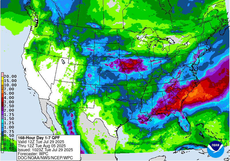
The latest 7-day precipitation map shows that we are entering a rainier pattern in the next week. The heaviest rain will be concentrated along a band that stretches from southern Alabama through the Florida Panhandle, the coastal plain of Georgia and South Carolina, and continuing along the coast to include eastern North Carolina. The Appalachian Mountains could also see several inches. This will be relief for many areas, where hot and dry conditions have been putting a lot of stress on crops, but it could mean delays in fieldwork due to the rain. Watch the forecasts carefully if you are applying anything affected by rainfall or even moisture. The Weather Prediction Center is watching for the likelihood of heavy rain on August 1-2 along the East Coast (see bottom diagram) so that might put a damper in some beach plans for folks who are looking for one last fling before school starts. At least the weather will be a little bit cooler!