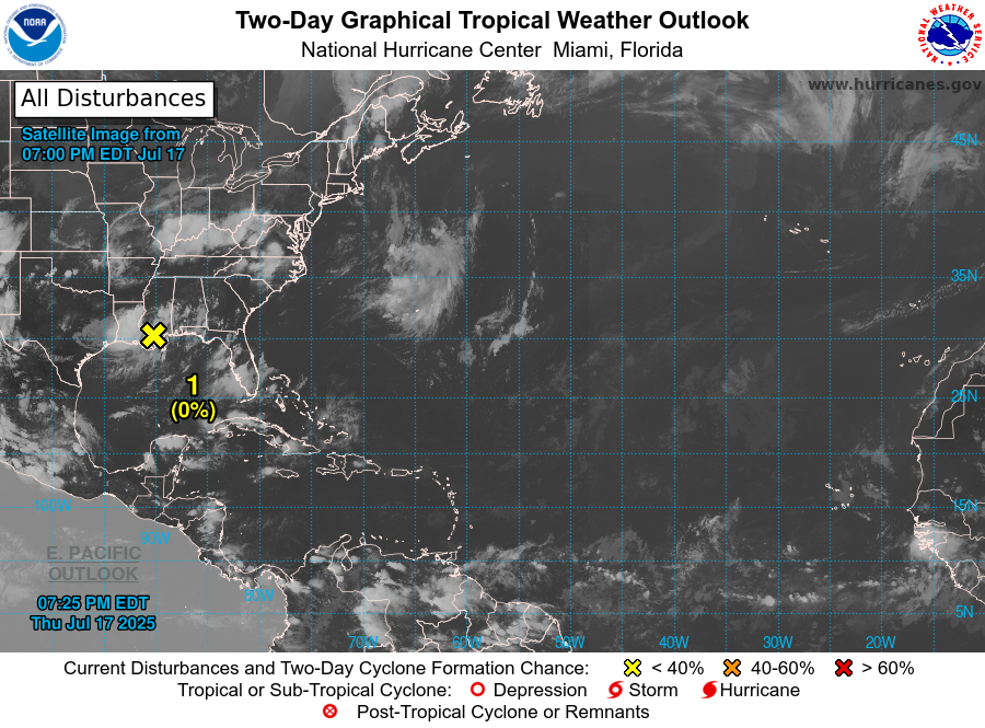
The area of disturbed weather that formed off the Southeast Coast earlier this week has traversed the Florida Peninsula and moved westward along the northern Gulf Coast, but never found the warm water and atmospheric support to develop into a named storm. It is now moving inland to the north and there is no further chance of development. However, there is still plenty of moisture with this blob of thunderstorms and flooding rain is likely due to the slow movement of the circulation. The rest of the tropics looks quiet for the next week or two, but the main period of activity starts in mid-August so there is plenty of time for the wave train to crank up as we head for the heart of the season, so don’t call the forecast for an above-normal season a bust just yet.