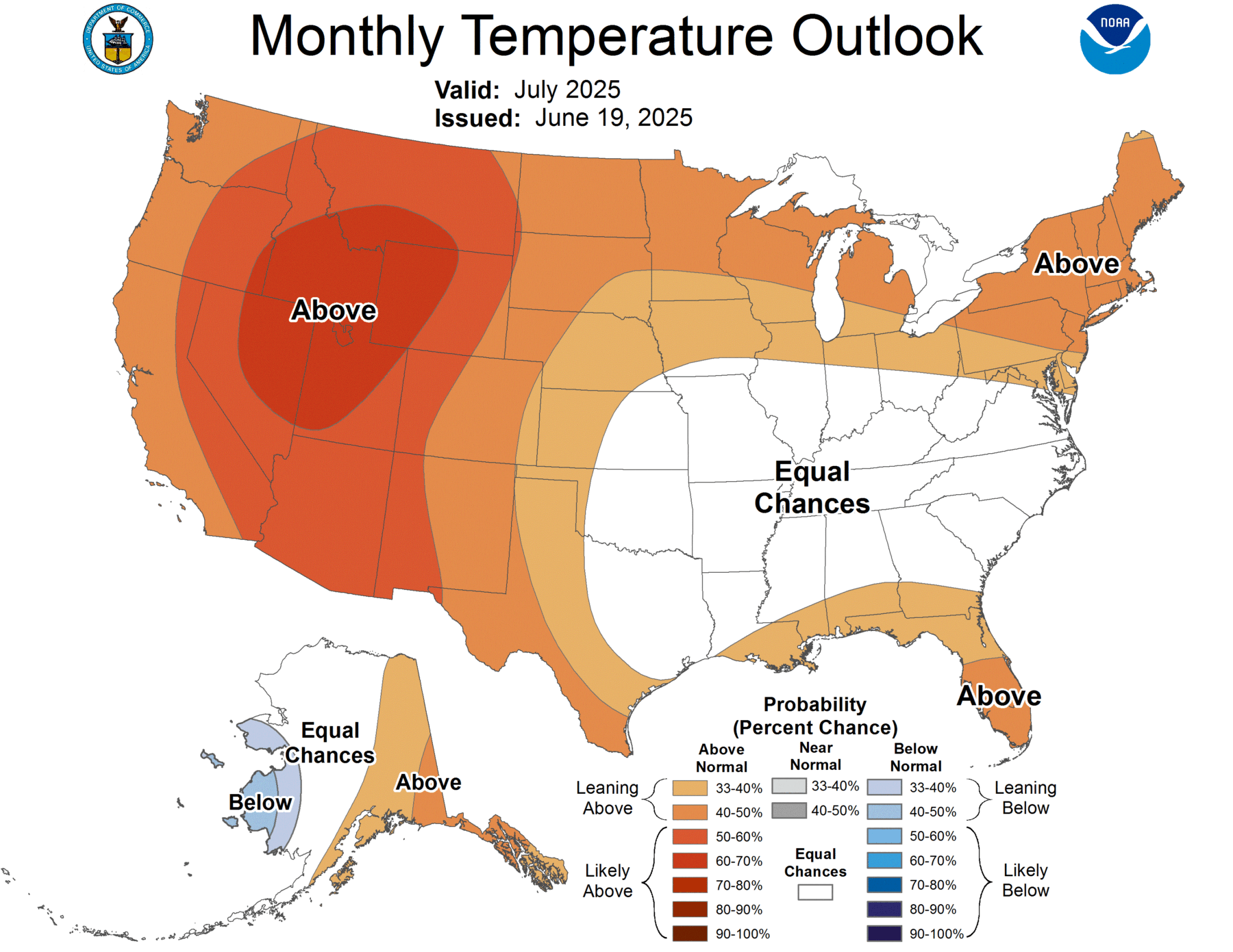
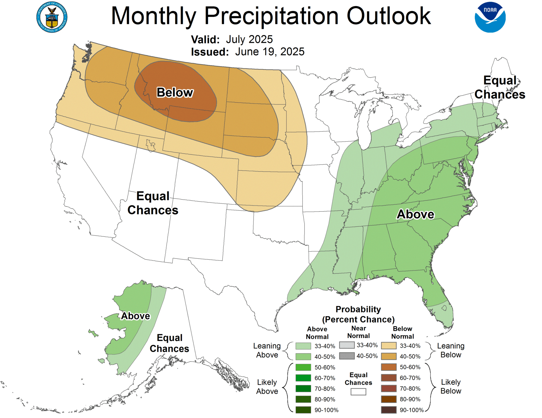
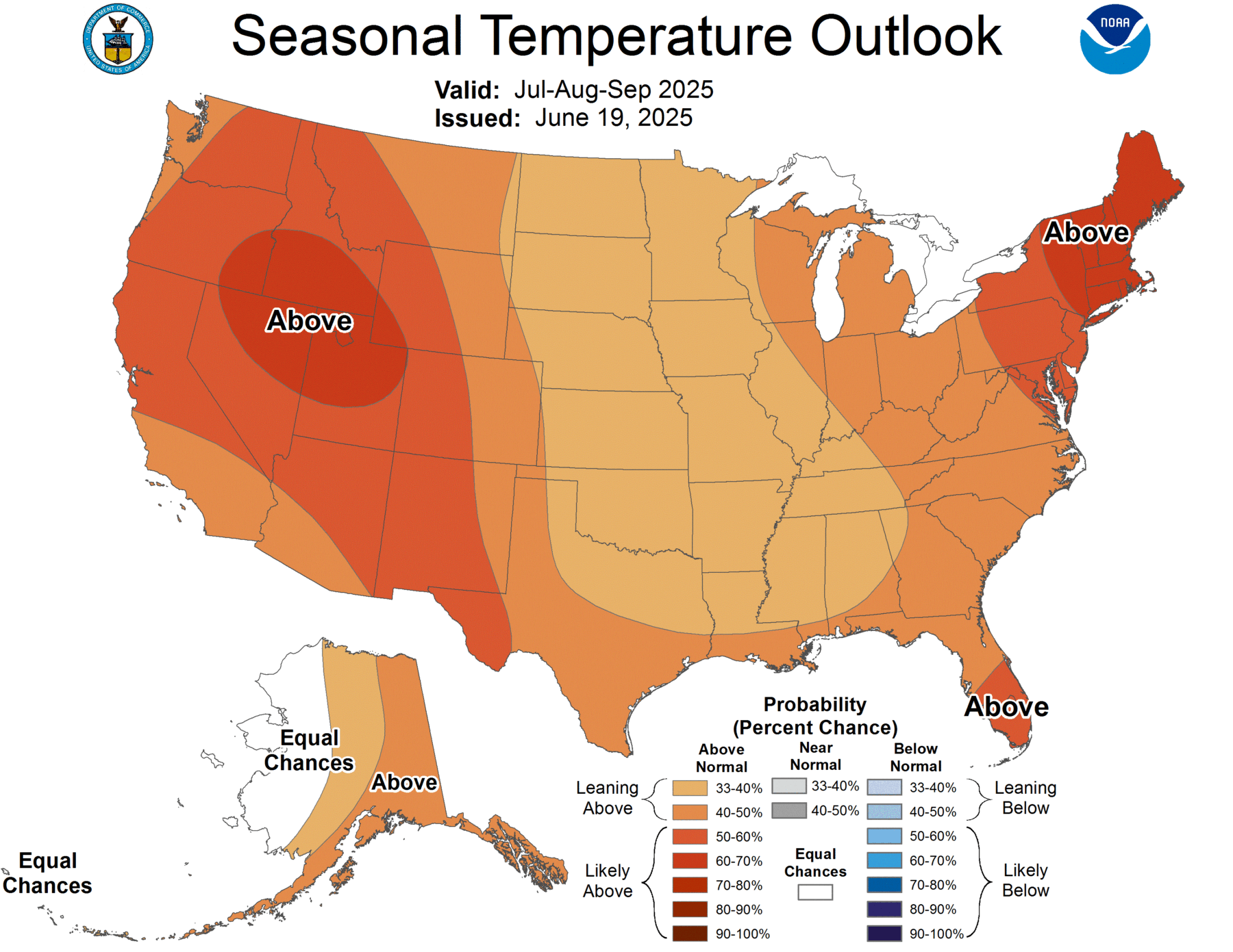
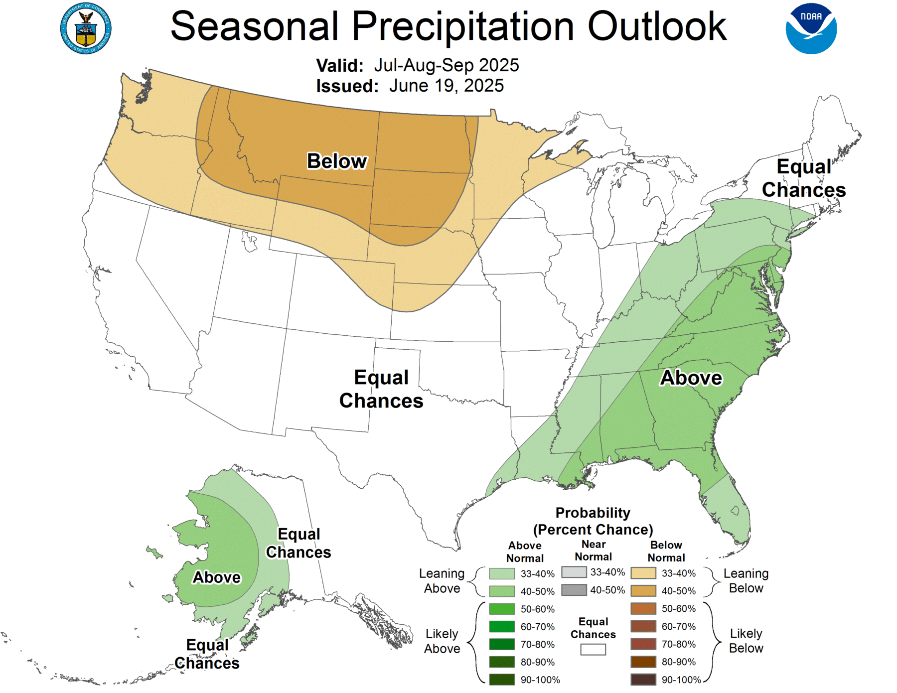
NOAA’s Climate Prediction Center released their updated monthly and seasonal climate outlooks earlier this week. They show that the July-September period is expected to be warmer than usual although July alone has equal chances of near, above, and below normal temperature in spite of the end of June being very hot. The same periods are also expected to be wetter than normal for most of the region. This means that drought is not likely to be an issue, but short-term water deficits could still occur, especially if it stays hot.
I attribute a lot of the extra rainfall to be due to the likely active tropical pattern we are expected to see later in the year. Don’t be fooled by the lack of storms so far this year. Many of the most active seasons got a late start and the Gulf of Mexico is plenty warm, so once the Saharan dust decreases, we can expect to see some more action, although nothing through the first week of July is predicted right now.
The early predictions for the last quarter of 2025 and the first quarter of 2026 show a pattern similar to last year, reflecting the likelihood of neutral or weak La Nina conditions then. You can see those maps at https://www.cpc.ncep.noaa.gov/products/predictions/90day/.