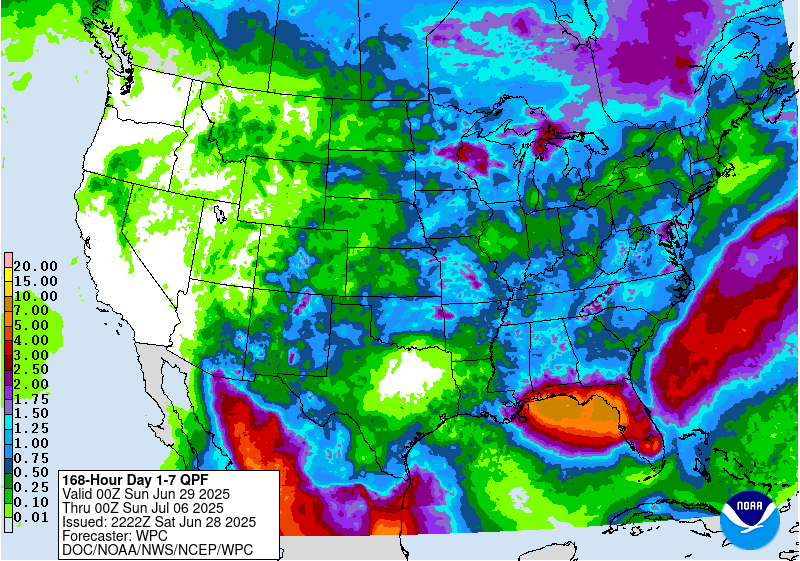
The latest 7-day QPF map shows that the heaviest rain this week will stay off the coast in the northeastern Gulf of Mexico, but areas that border that, especially southern AL, the Florida Panhandle, and the west coast of Florida, could all see a lot of rain over the next week, with frequent showers occurring. Other parts of the region are expected to receive much rain and it should be dry for most of the region other than the Gulf Coast by mid-to-late week.
Above normal temperatures are expected for the next two weeks. Precipitation in week 2 should be a little higher for the inland areas of the Southeast than this coming week, but keep in mind that thundershowers can occur frequently in this warm and humid air, they just provide spotty rain that can hit some other areas hard while missing many other areas completely. The rain tends to be heavier in areas where the storms occur because the steering currents are weak and the storms only drift slowly, dropping a lot of rain in a small area.