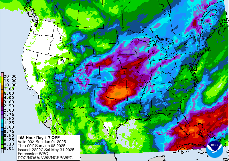
The latest 7-day QPF map shows that most of the region should receive less than half an inch of rain this week except for the southern half of the Florida Peninsula, which should receive much more. That should put a dent in the drought there, which has been growing for the last few weeks. In the rest of the region, no rain is expected for the next three days except showers in North Carolina. Rain chances will increase later in the week but rain amounts will still be small. Note that the Climate Prediction Center is indicating above-normal chances of wet conditions across the region for weeks 2 through 4, so no drought is expected in most of the region.
Note that social media hype on potential tropical systems forming and reaching the northern Gulf Coast next week are just eye candy with no basis in science at this point. Don’t feed the trolls and click on this bait! We do expect some increase in tropical activity in the next ten days as the favorable phase of the Madden-Julian Oscillation moves into our region, but there is nothing definitive beyond that. CPC is showing a 20% chance of tropical development in the area around the Yucatan Peninsula June 11-17 but there is nothing more specific than that at this point. Put your energy into doing general preparations for the tropical storms that will occur later in the year, not focusing on something that has just 1-2 percent chance of occurrence (if that).
