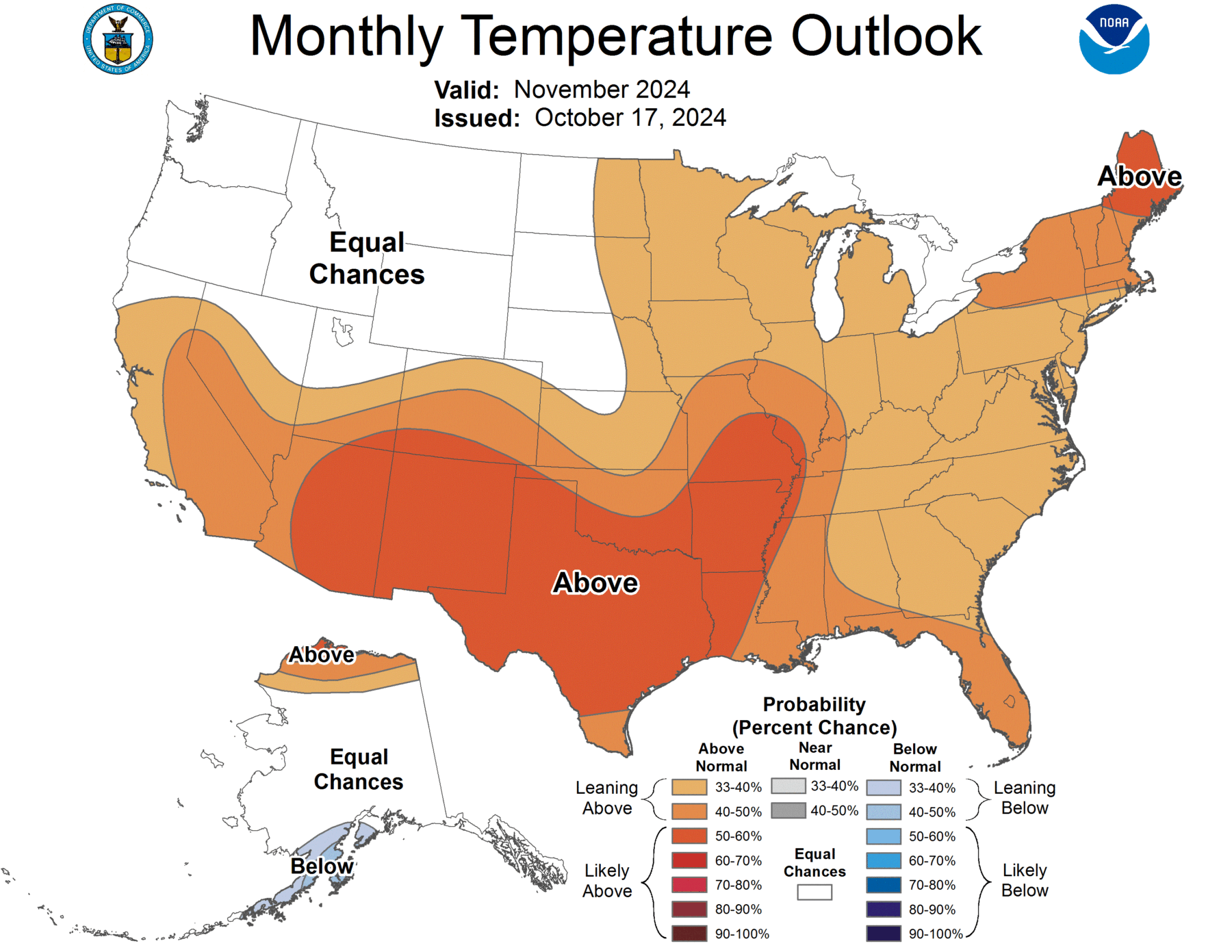
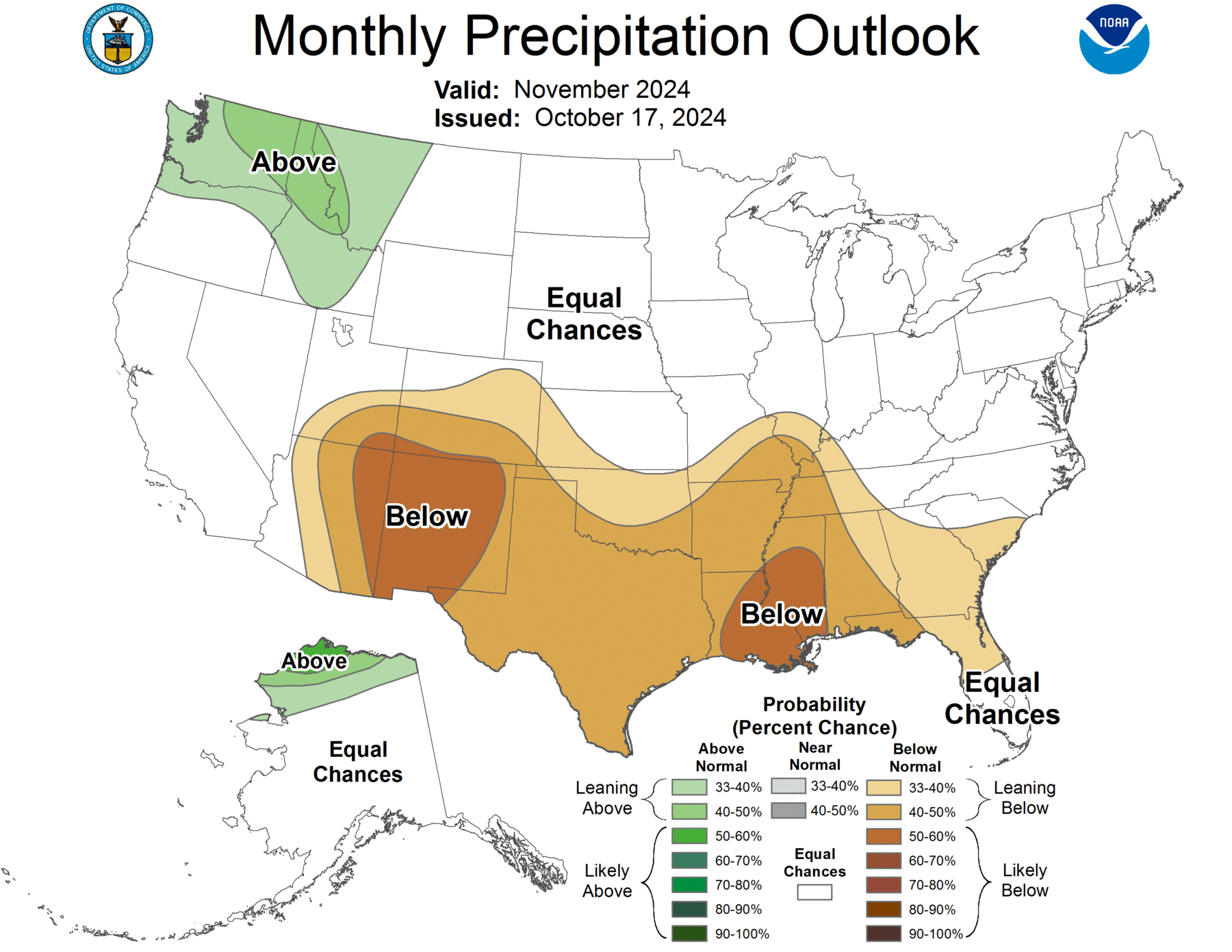
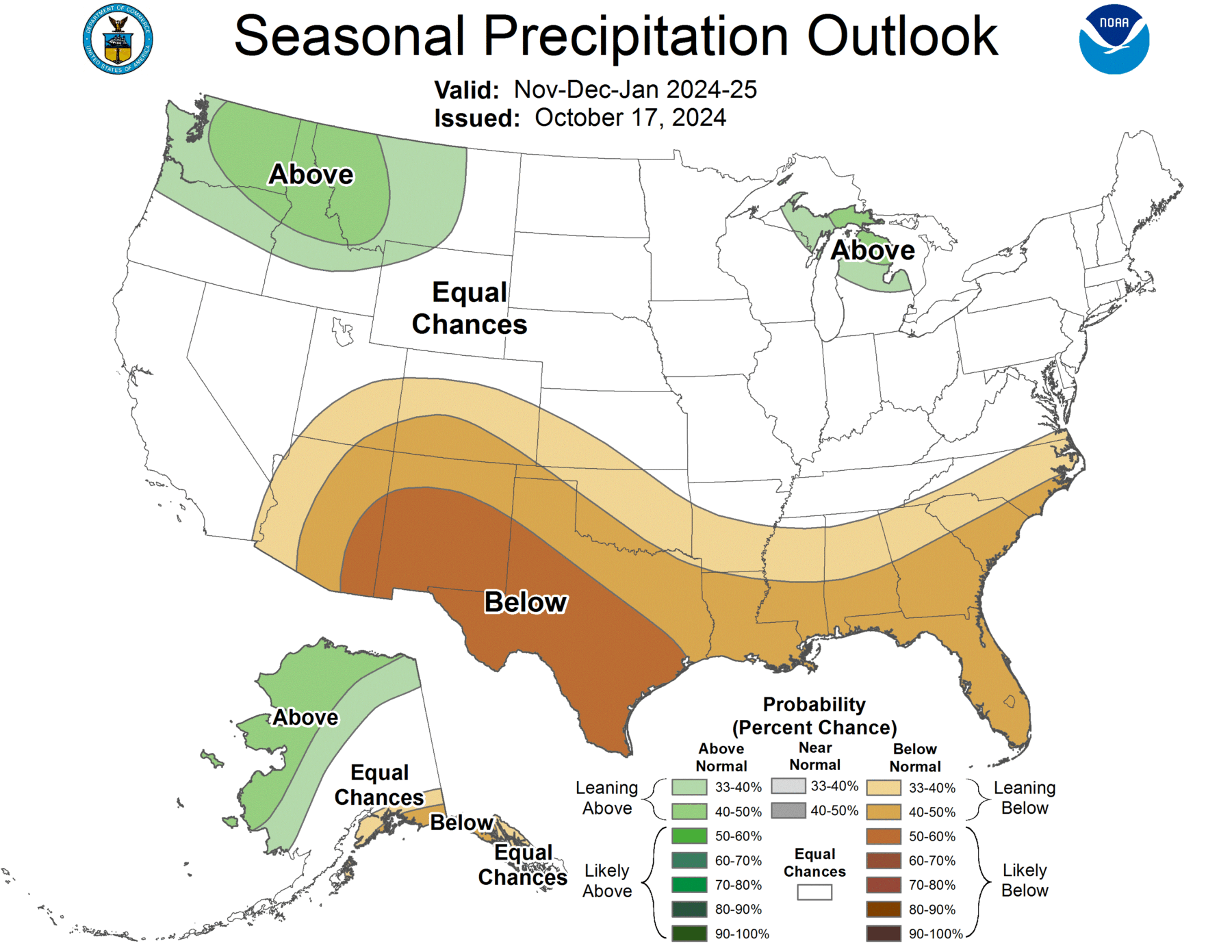
NOAA released their official winter outlook today. The two major factors that are driving this winter’s outlook are the weak La Nina that is expected anytime now and the trend towards warmer temperatures across the globe due to greenhouse warming. The weak La Nina is expected to displace the winter jet stream to the north over the Ohio River Basin. This will shift the location of the wettest conditions northward and leave the southern part of our Southeast region with the likelihood of warmer conditions than normal for the next few months, although there may still be some cold outbreaks scattered in the warm conditions. It will still be winter, after all. Since the jet stream pushes the rain-producing winter storms along, southern parts of our region are also expected to be drier than normal for the next few months.
The effects of a weak La Nina are generally the strongest in southern Alabama and Georgia and down into Florida, while northern Alabama and Georgia may feel more influence of the jet stream and the likelihood of warm and dry conditions there is lower. At the same time, winters are warming more quickly than any other season in the Southeast, and that will increase the chances of a warm winter here. The combination of our already dry conditions, especially in Alabama, plus the warm and dry climate we expect is likely to lead to the expansion of drought in the western part of the region. You can read more and see a video discussing the outlook at https://www.noaa.gov/news-release/us-winter-outlook-warmer-and-drier-south-wetter-north. Note that the outlook maps for December through February are in the link above, not shown below (those are for November through January and were also released today), although the patterns are similar.