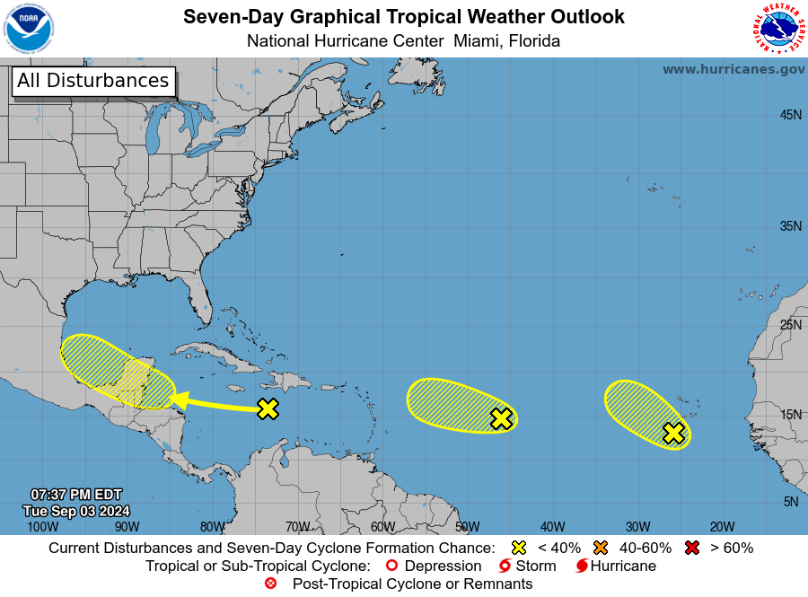
I’ve been getting a lot of questions about why the Atlantic hurricane season recently has been strangely inactive considering we are currently near the climatological peak of activity. It is even more puzzling because all of the forecasts for the season were for well-above-normal activity, with the possibility of 17-25 named storms, and we started the season off strong with Hurricane Beryl as well as some other named storms. Beryl reached Category 5 level as it dropped a lot of rain on the Texas coast as well as caused a lot of wind and storm surge damage. But since Ernesto developed on August 12, we have only seen some weak low pressure centers moving west in the equatorial Atlantic and none of them seem too likely to grow. The three that are there now are not strong systems and have a low chance of developing. What has caused the pause in the production of tropical cyclones? According to the Weather Underground blog, it is because the atmosphere is too stable for storms to develop and Africa is so wet that the waves moving across the continent are farther north than usual, affecting the movement of the waves.
It is important to keep in mind that we are not yet even halfway through the tropical season, so there is still plenty of time for more storms to development. Certainly, parts of the Southeast could use some rain from tropical systems even if they would rather avoid the winds that often come with the storms. Drought has been expanding in areas that were not hit by the remains of Debby and even there, things are drying out. So continue to watch for signs of activity to fire up and prepare for storm conditions if they approach your area.
