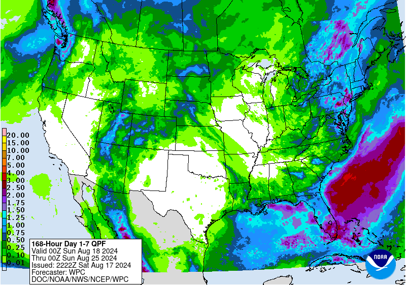
The latest 7-day QPF map shows that most of the region should be relatively dry over the next week with the exception of Florida and areas right next to the coast. The rain that does fall will occur over the next couple of days as some waves of severe weather move through the region ahead of a cool front that is approaching. After the front passes, rain should end except in the south where it stalls. It will bring some pleasantly cool air to most of the region, so even though it will be dry, it will be less stressful to the plants (and farmers) than if the heat was continuing. Alas, it won’t last, so enjoy it while you can.
The tropics right now are very quiet, but there are regular waves coming off of Africa so once the Saharan dust ends and wind shear decreases, we are likely to see multiple storms developing over short time periods. The Climate Prediction Center is highlighting the period from August 28 to September 3 as a likely period of development. The storms that develop in August and September are usually Cape Verde storms that form in the eastern or central Atlantic, so any that do appear are likely to show up long before they might hit the Southeast, giving producers and others time to prepare.
