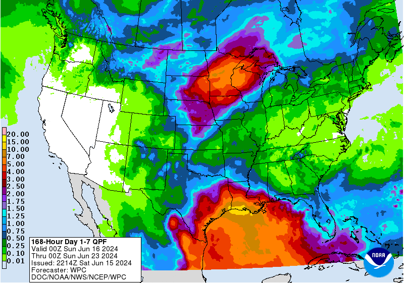
The latest 7-day QPF map shows that most of the Southeast is expected to get very little rain in the next week due to the presence of a strong high pressure center across northern parts of the area. This high pressure is also going to bring very hot conditions to the region, especially in northern sections. The lack of rain coupled with the high temperatures will put a lot of stress on developing crops. I have seen corn crops tasseling and getting close to pollination, and the hot and dry weather could cause problems for dryland fields if no rain comes.
The tropics continue to show signs of activity, but most of it is in the southern Gulf of Mexico and is expected to move slowly westward. The QPF map shows a lot of rain in the Gulf and extending north into Louisiana and Texas, but most of that will not reach us in the Southeast. The wettest areas are expected to be the Mobile area and the Florida Peninsula, although they will not get nearly as much as they did last week. Weeks 2-4 show a continuation of hot conditions is likely to occur. Rain should increase in week 2 but may be less plentiful in weeks 3-4. The longer-range models are showing more likelihood of tropical development later in the month (especially the GFS, which pops up tropical storms at the drop of a hat this time of year, although most of them disappear in the next computer runs). If you have not gotten your preparations done for documenting storm damage and protecting your family, now is the time to get those finished.