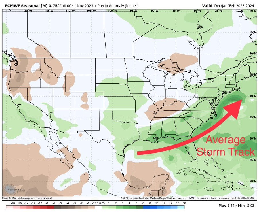
I continue to get questions about when the El Nino winter rains will kick in. While it looks like we will have a few more warm and dry days this week, rain is returning to the region on Thursday and will help to shift us out of the long dry pattern. Areas in southern GA and AL and northern FL may have to wait a few more days after that before the rainy weather gets down to those locations, but it does look like the shift will be coming by mid-November. And the European Seasonal Climate model (generally regarded as the best of the climate models) is showcasing a Dec-Feb precipitation pattern indicative of an average storm track originating in the western Gulf of Mexico and running up the Eastern Seaboard. This is exactly what we expect from a strong El Nino, so that gives us more confidence that we will see a typical El Nino precipitation pattern later this year, although it might take a while for this pattern to get going. I think by late this week we will have a better sense of how quickly the pattern might shift. I know this is frustrating for people who need rain now to plant winter forage and small grains (and it may be too late already considering how much of the region has now experienced a freeze) but it does bode well for good conditions going into the next growing season.