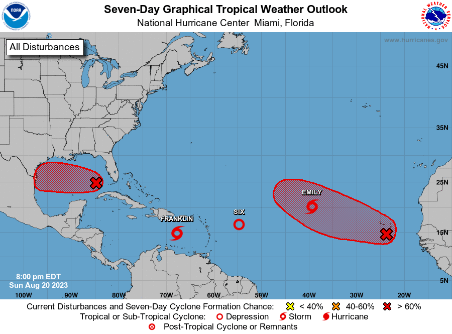
Update: Gert formed overnight between Emily and Franklin from TD 6 but is not expected to last long.
In the past day we have had two new named tropical storms in the Atlantic: Emily and Franklin. There are also two additional areas that have a 70% chance of becoming named storms in the next week. The next two names are Gert and Harold. One additional area is designated as Tropical Depression 6 but that is not expected to last long. Fortunately, Emily is likely to stay completely out to sea (we call that a “fish storm”) and Franklin is expected to turn sharply north and cross Hispaniola before heading into the North Atlantic. Of the two additional areas, the one in the Eastern Gulf is heading due west and will probably bring rain to southern Texas but won’t affect the Southeast. The other one is a wave that just came off of Africa so where it will go is unsure but nothing to worry about for the foreseeable future. The biggest take-away from this increase is that we have now entered the peak period for tropical storm development in the Atlantic and can expect more action in the coming weeks. Meanwhile, Tropical Storm Hilary came onshore in Mexico and is over California on Sunday night, bringing a lot of unseasonal rain to southern California.