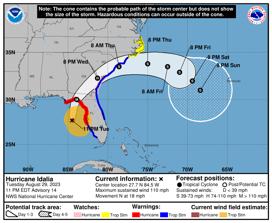
As of 11 pm, Idalia has strengthened to just under a Category 3 storm with winds of 110 mph and a small eye and is expected to continue to strengthen overnight before it makes landfall in Florida tomorrow morning. The forecasts have been shifting slightly west all day, and observers are watching carefully on Tuesday evening to see when the storm starts to make its curve to the northeast. Impacts from the storm are dependent on exactly where the storm makes landfall but will be widespread in an area that has not seen a storm like this in 172 years of historical records. The storm surge will be particularly bad in Florida’s Big Bend because the shelf there is shallow and the configuration of the coastline allows a lot of water to pile up. The peak storm surge was raised to 12-16 feet because of the increased intensity.
Hurricane winds are likely to continue into Georgia as well and will have widespread impacts on late-planted corn, cotton, peanuts, and pecans among other crops before it moves into South Carolina as a tropical storm. By the time you read this on Wednesday morning, Idalia may already have made landfall but if it slows down and is still out over the Gulf, it will have continued to intensify overnight, leading to higher winds and impacts when it does cross the coastline.