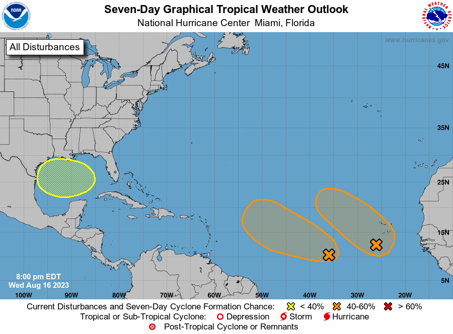
The latest 7-day tropical outlook shows that the two disturbances that appeared earlier this week now both show a 50% of developing into a named storm in the next week, although the eastern one is not likely to approach land if it forms. A third area of interest is now depicted in the Gulf of Mexico with a 20% chance of developing in the next week. Forecasters are not sure where that blob of moisture may go yet since it is not defined but are mostly watching its potential for rain in Texas, which really needs it. We will want to keep an eye on this area for future development, especially since the Gulf of Mexico is so warm, but nothing to be concerned with yet at this point other than the potential for some rain. Meanwhile, southern California may see a rare interaction with a tropical system later this week. That could potentially bring flooding rain to a part of the country that rarely sees it this time of year.