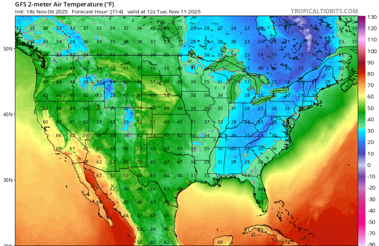
A blast of very cold air will be entering the Southeast beginning on Sunday and will bring freezing temperatures to a lot of the region. On Monday morning, the freezing temperatures will cover northern Alabama, all of Tennessee, and higher elevations of Georgia, the Carolinas, and Virginia. Temperatures will warm up during the day somewhat, but by Tuesday morning the cold temperatures will reach down to cover almost all of Alabama and Virginia and will surge to the Fall Line and beyond in Georgia as well as in the Carolinas. There may also be some patchy freezing temperatures in south central Georgia as well as in northern Florida on Tuesday morning. This outbreak is rare and deep, and some of my climatologist friends tell me this is a 3 to 5 sigma event (that’s standard deviations from normal), which means it is rarer than 1% occurrence. The AgroClimate map below shows that this occurs in fewer than one out of ten years in southern parts of the region (from http://agroclimate.org/tools/freeze-risk-probabilities/). There will be no freezing weather in southern Florida or in Puerto Rico, though.