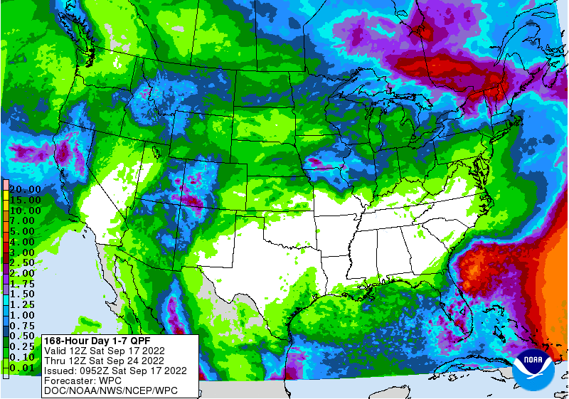
High pressure and completely dry conditions are expected to continue for most of the Southeast in the next week. The exceptions are coastal areas and the Florida peninsula, although the heaviest rain will remain off the coast. The streak of heavy rain you see in the map in the Atlantic marks the path of TS Fiona, which is strengthening this morning before it starts to make its expected turn towards the north. Puerto Rico is likely to see heavy rain and wind from the storm, but impacts on the rest of the Southeast are likely just to be some waves and rip currents along the East Coast. Weeks 2 and beyond show that this high pressure is likely to persist as we enter the driest time of year, although there will be some rain, especially near the coasts.