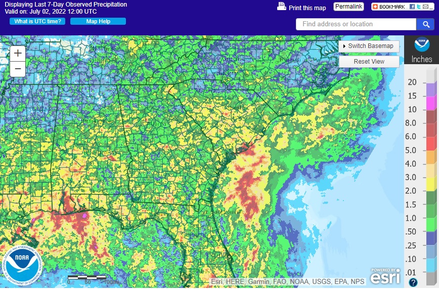
The current pattern of afternoon showers and thunderstorms is expected to continue this week. Most areas will see some rain, but there will be a few folks won’t get any due to the spotty nature of the storms. The first map below shows the predicted amount of rainfall for the next week, and the map below that shows what actually fell (radar estimate from https://water.weather.gov/precip) last week. Sometimes there are large variations within a county, and that is why having extra sources of information like CoCoRaHS can be helpful if you are trying to document dry conditions. The big streak of rain off the East Coast is due to TS Colin, which formed overnight after creeping along the coast north from Florida over the past few days. I have a related post today on Colin.