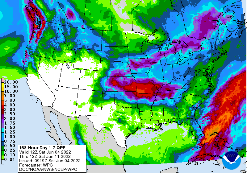
The latest 7-day QPF map shows that most of the rain this week will fall either in southern Florida or in the Southern Appalachians. South Florida is still experiencing the effects of Potential TS #1, which dropped over 10 inches of rain in parts of Miami yesterday; it is still raining there as the storm moves across the peninsula. Most likely the storm will become named storm Alex after it goes back over the Atlantic Ocean and crosses the Gulf Stream, but for now it is too disorganized to name. You don’t need a named storm to cause tropical havoc! Most of the rest of the region will see less than half an inch of rain along with warm temperatures, so we could see some increases in abnormally dry conditions in the next Drought Monitor map.