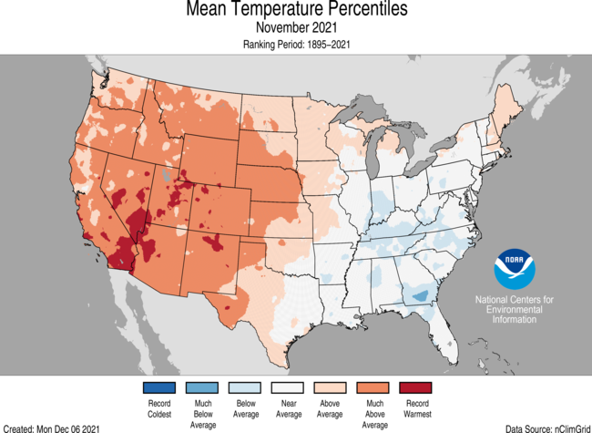
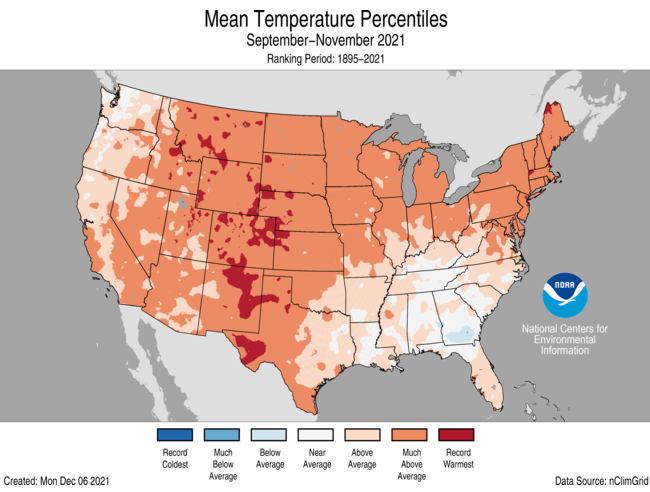
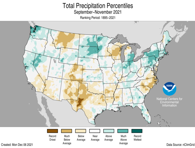
You might not think it if you live in the Southeast, but the month of November for the US as a whole was the 7th warmest on record (going back to 1895) due to the very warm conditions out west where there is a bad drought. Here in the Southeast, most of the region was near to well below normal in temperature, especially in southern Georgia where wet soils from earlier in the year and cloudy conditions have really kept temperatures down. This is true not just of November but for fall as a whole. Precipitation in November was well below normal this year in most of the Southeast except for the Florida peninsula, which was quite wet. But for fall as a whole, most parts of the Southeast were wetter than normal, with the big exception of eastern North Carolina, South Carolina, and Virginia, where drought has been expanding rapidly due to the dry conditions there. It’s not unusual to see a split pattern like this when you have a large-scale atmospheric wave pattern (in this case, high pressure in the west and low pressure in the east) that is locked in place. This one has lasted longer than most, even for fall which is normally pretty dry in the Southeast. But this week the pattern has shifted and brought some much-needed rain to the region, so I expect to see a much different climate pattern in December. You can read more at “U.S. had its 3rd-warmest autumn on record, 7th-warmest November | National Oceanic and Atmospheric Administration (noaa.gov)“.