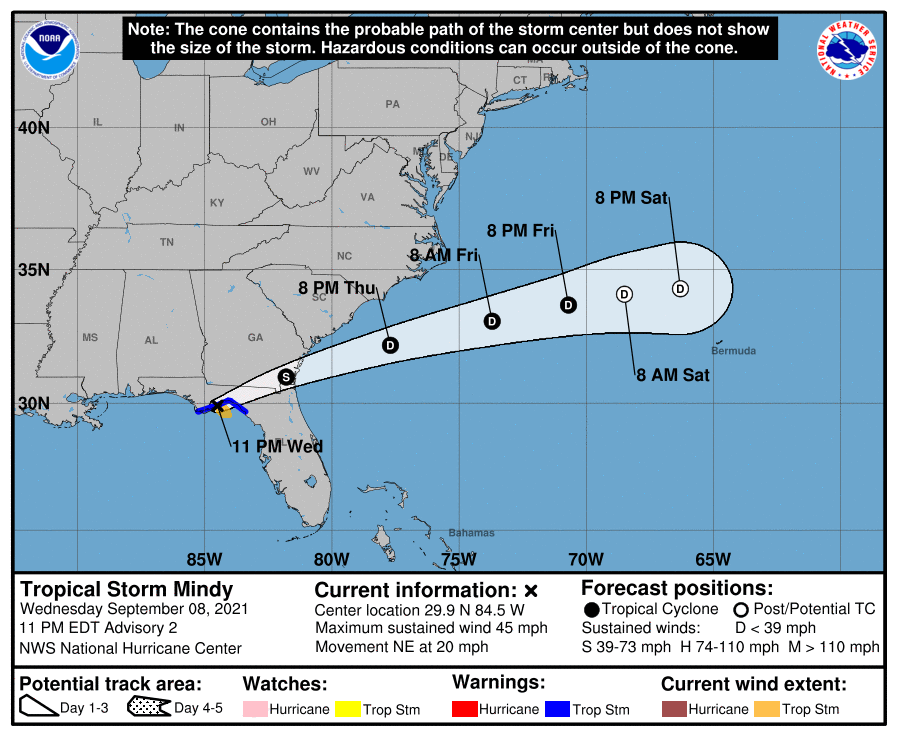
If you were paying attention to the news today, you learned that Tropical Storm Mindy formed this afternoon over the eastern Gulf of Mexico and as of 11 pm on Wednesday, is moving along the Florida Panhandle towards the east at about 20 mph. It is expected to reach the southeast corner of Georgia by Thursday morning. It is accompanied by some rain and gusty winds, but is not expected to be a significant threat to the region. While some people think Mindy appeared “out of nowhere” the central disturbance has been under watch for nine days from when it developed near the coast of Columbia. It pulled itself together into a closed circulation and was named Mindy just a few hours before it made landfall. The average date of the first “M” storm in the Atlantic is October 25, so we are well ahead of an average season.