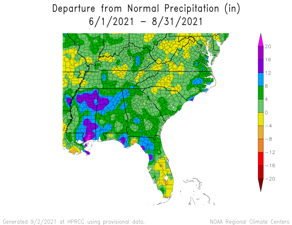
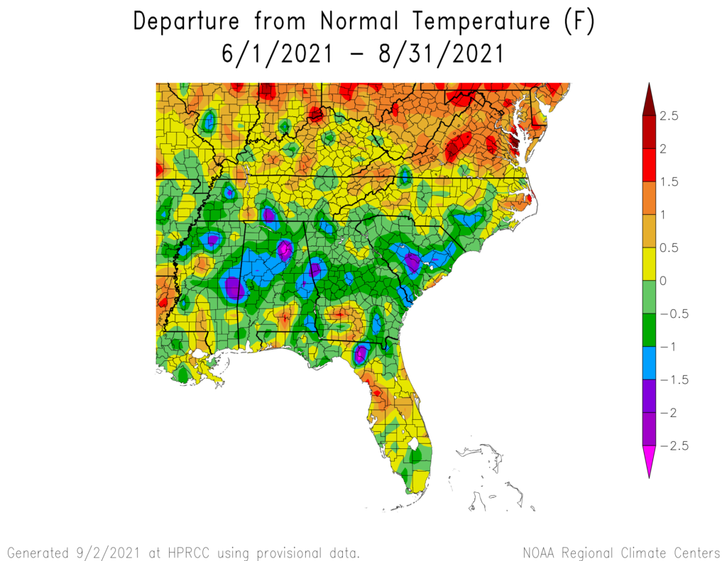
With the end of August, we have reached the official end of climatological summer in the Northern Hemisphere. Maps of the temperature and precipitation departures show that in general, the precipitation was wetter than normal and the temperature was cooler than normal, although as usual there is quite a bit of variation across the region. In general, the areas with the coolest temperatures were also the wettest. This is reflected in lower than average daytime high temperatures, which are related to cloudiness during the day, and in warm nights, which are related to higher humidity values. Keep in mind that Hurricane Ida’s rain in northern parts of the Southeast fell in September, not August, and so are not reflected in this map.