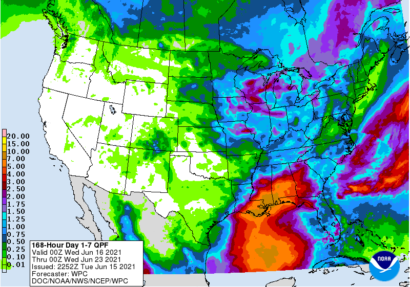
As I discussed yesterday, there appears to be a possible tropical storm brewing in the Bay of Campeche this week. There is nothing organized there now, but computer models suggest that a circulation has an 80% chance of developing into a tropical depression that is expected to head north. If and when that happens, it is likely to remain quite weak and may never get to tropical storm status. However, it will have copious amounts of rain associated with the circulation, and that could impact farmers in western parts of the Southeast by this weekend. The heaviest rain will depend on the path, and that is not predictable until a circulation forms, but in general it is expected to move north into Louisiana and then northeastward. The heaviest rain amounts will most likely been on the east side of the storm and near the center. That puts southern Alabama, the Florida Panhandle, and parts of southern and western Georgia in the area that is most likely to get wet. Timing also depends on a lot of factors, but generally you can expect to see some rain starting in Alabama on Saturday (potentially even Friday near the coast) and by Saturday night in Georgia. The map below shows one model prediction of rain over the next week. Note the dry conditions over Virginia and central NC that could increase the drought there.
Because of the unknowns in the storm’s development at this point, we can’t be specific about amounts of rain or timing, but if you have rain-sensitive work to do around your farm, whether it be hay cutting, chemical spraying, or other field work, keep those coming wet conditions in mind. The wettest period is likely to be Saturday through Tuesday, then drier conditions should return, at least for a while.