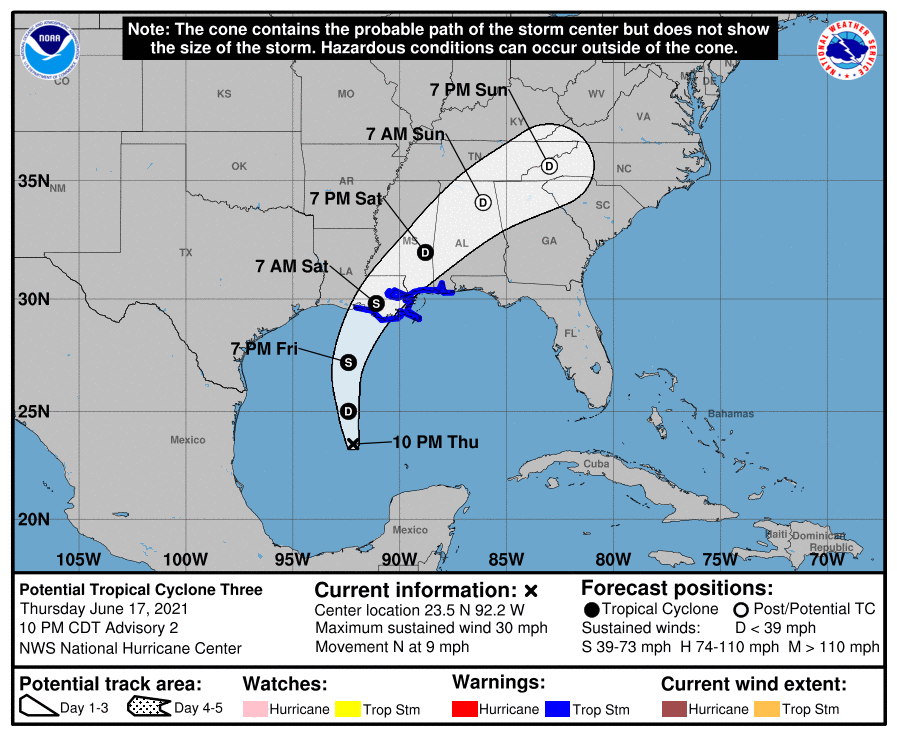
The National Hurricane Center is tracking a weak center of low pressure in the Gulf of Mexico that could develop into Tropical Storm Claudette in the next day. It is still quite disorganized, so predicting the path of the storm is somewhat difficult. However, the current path of the storm brings it onshore in eastern Louisiana as a very weak tropical storm. Remember, impacts from the storm can occur far outside the cone. After landfall it decreases to a tropical depression and moves towards the northeast, passing over Alabama and northern Georgia and the southern Appalachian mountains. Since it is going to be a weak storm, the biggest impact will not be the winds but the heavy rain and possible weak tornadoes that could occur along and to the right of the path starting on Friday. With soil in many of those areas already quite wet, it won’t take much wind to uproot some trees, so power outages and road blockages could be a factor along with the flooding rains. Please follow NOAA’s National Hurricane Center for information on the storm and your local National Weather Service office for local conditions and forecasts. Be safe and don’t drive over flooded roads!