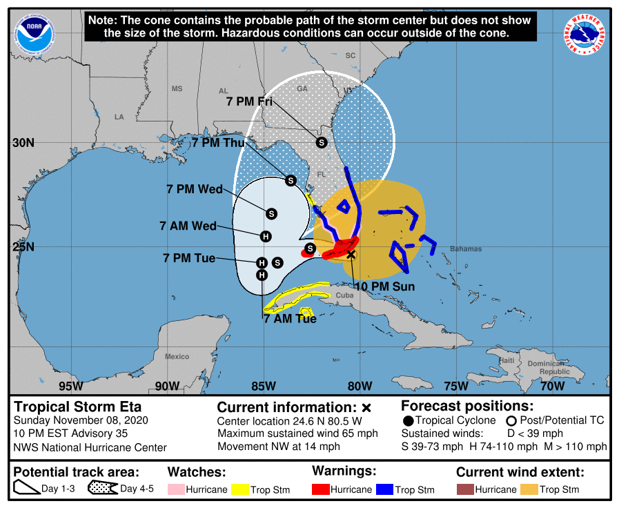
As of 11 pm EST, Tropical Storm Eta is located near the southern tip of the Florida Peninsula, hammering southern Florida with heavy rain and gusty winds. It is moving westward and is expected to move past the Keys and into the eastern Gulf by Tuesday morning. It could become a weak hurricane. At that point, it is expected to make a sharp right turn and move NNE and eventually make landfall somewhere along the NW coast of the Florida Peninsula overnight Thursday into Friday. However, the width of the cone indicates that there is a large amount of uncertainty with the path, so it could easily change by later in the week. Note that most of the rain and winds are located north and east of the storm’s center, so areas NE of the center of circulation could see tropical storm winds and rain far ahead of the center.
At the same time, a strong front is moving into the region from the west. That will also bring rain to the area by Tuesday. The interaction of the front and Eta is tricky to forecast and accounts for the large uncertainty in what is expected to happen. Either way, there will be a lot of rain and clouds over Georgia and the Carolinas by Tuesday and for several days after that, which will not be good for harvest of cotton and peanuts, although the rain would be welcome in east central GA and SC where it has been quite dry and producers are having a hard time establishing winter forage and small grains.
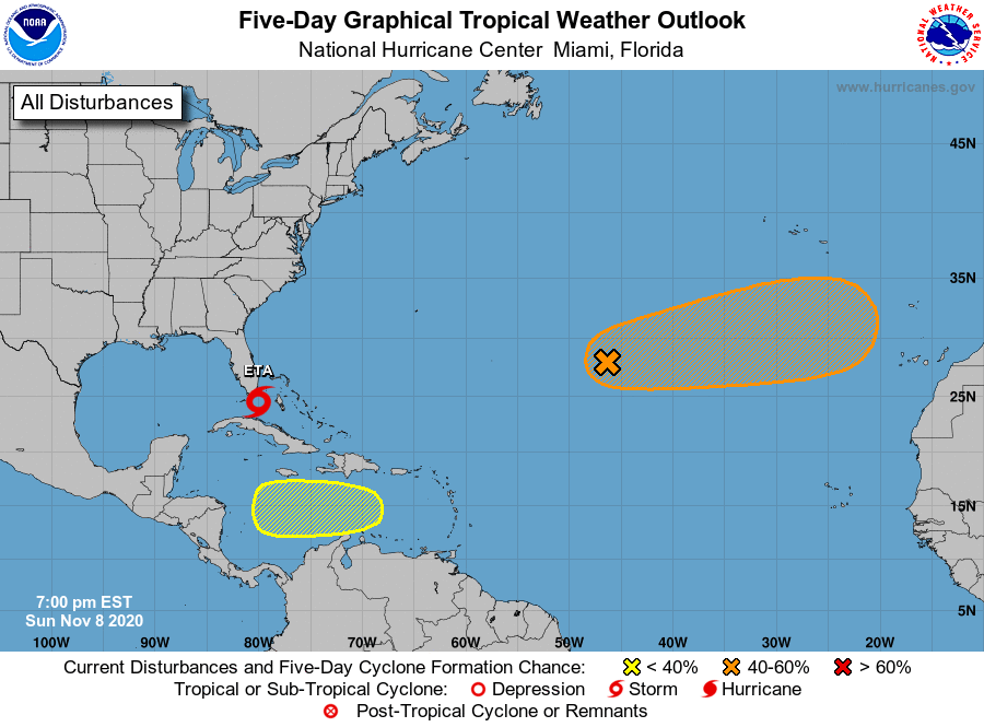
Meanwhile, there are two areas of potential development in the Atlantic which could produce named storms in the next week. The one in the central Atlantic is moving east and will not affect us. The area in the southern Caribbean could develop into something that may be a factor in a week to ten days. The Atlantic tropical season is not over yet.