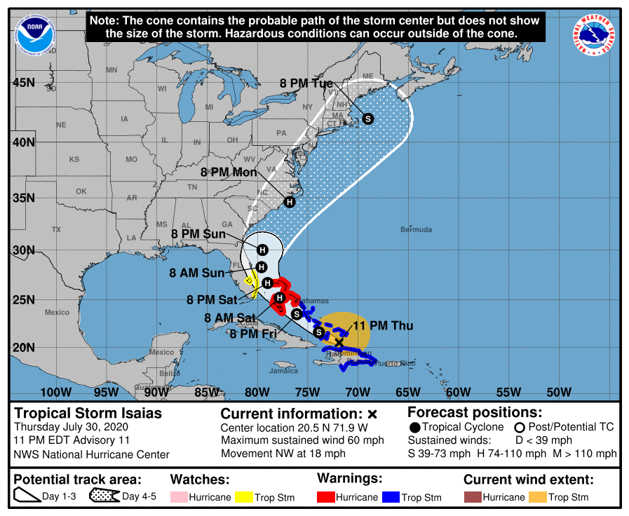
The latest forecast for TS Isaias, issued at 11 pm on July 30, 2020, shows that as the storm passed Hispaniola, the center of the storm reorganized to the north over water. Its path over the next few days should keep it mostly over water, so it is now expected to become a Category 1 hurricane by the time it gets close to the US. The most likely path will keep the storm offshore until it gets close to the Carolinas, although there is a chance it could move along the west side of the forecast cone and come onshore earlier.
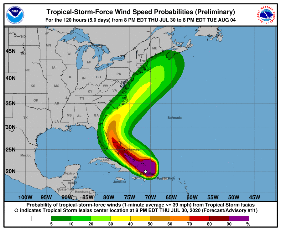
The biggest impacts from the storm are likely to be strong surf along the East Coast (no swimming if you go to the beach,although I don’t recommend it in case the storm comes close to shore) and some coastal erosion, possibly higher than normal tides while the storm is blowing wind onshore, and squally winds and rain near the storm. The highest chances of impacts will be for areas close to the coast, with chances decreasing the farther away from the coast you get. Areas to the west of the storm’s path could see little to no rain in subsiding air around the storm, especially in areas that are already dry.
Be sure to continue to visit the websites of the National Hurricane Center for updated forecast tracks and timing and your local National Weather Service office for conditions in your area. Remember, this is just one of what could be several tropical systems that hit the Southeast in this active year, so make sure you have supplies and plans ready to go when the next one comes. The main part of the season has not even begun yet. Fortunately, the next wave coming off of Africa looks like it will probably fizzle, so nothing coming in the near future.