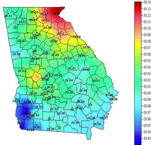
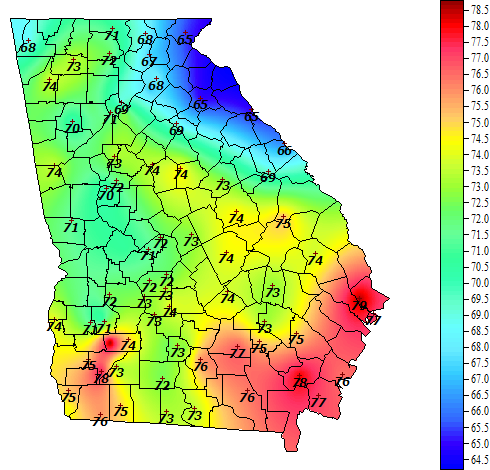
In the past I have talked about the “wedge”, which is an atmospheric phenomenon that we experience from time to time in northeast Georgia. When conditions are right, a strong flow of cool, high pressure air flows south along the east side of the Appalachian Mountains into Georgia, bringing air that is cooler, usually drier, and higher pressure than the air it replaces. We are seeing that tonight, and that will bring cooler and drier air into northeast Georgia for the next few days before it retreats back north. You can see it in the maps of pressure and dew point at the UGA weather network, which shows the high pressure and dry air entering the state in the northeast corner. Enjoy the fall-like weather while it lasts!
If you want to read more about the wedge, also known as cold air damming, check out this page: https://www.iweathernet.com/educational/cold-air-damming.