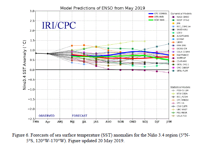
The latest edition of the El Niño outlook was published this week. It shows that El Niño is well entrenched in the central Pacific, with cooler conditions in the eastern Pacific due a temporary Kelvin wave. Virtually every statistical and dynamical model predicts that this El Niño will continue for the next few months, potentially into next winter. While El Niño impacts on climate in the Southeast in summer are relatively weak, we do expect that the potential for hurricanes will be somewhat reduced. We also expect that next winter may be wetter than usual, although where the wettest conditions will be depends on exactly how the event develops. You can read the outlook here.