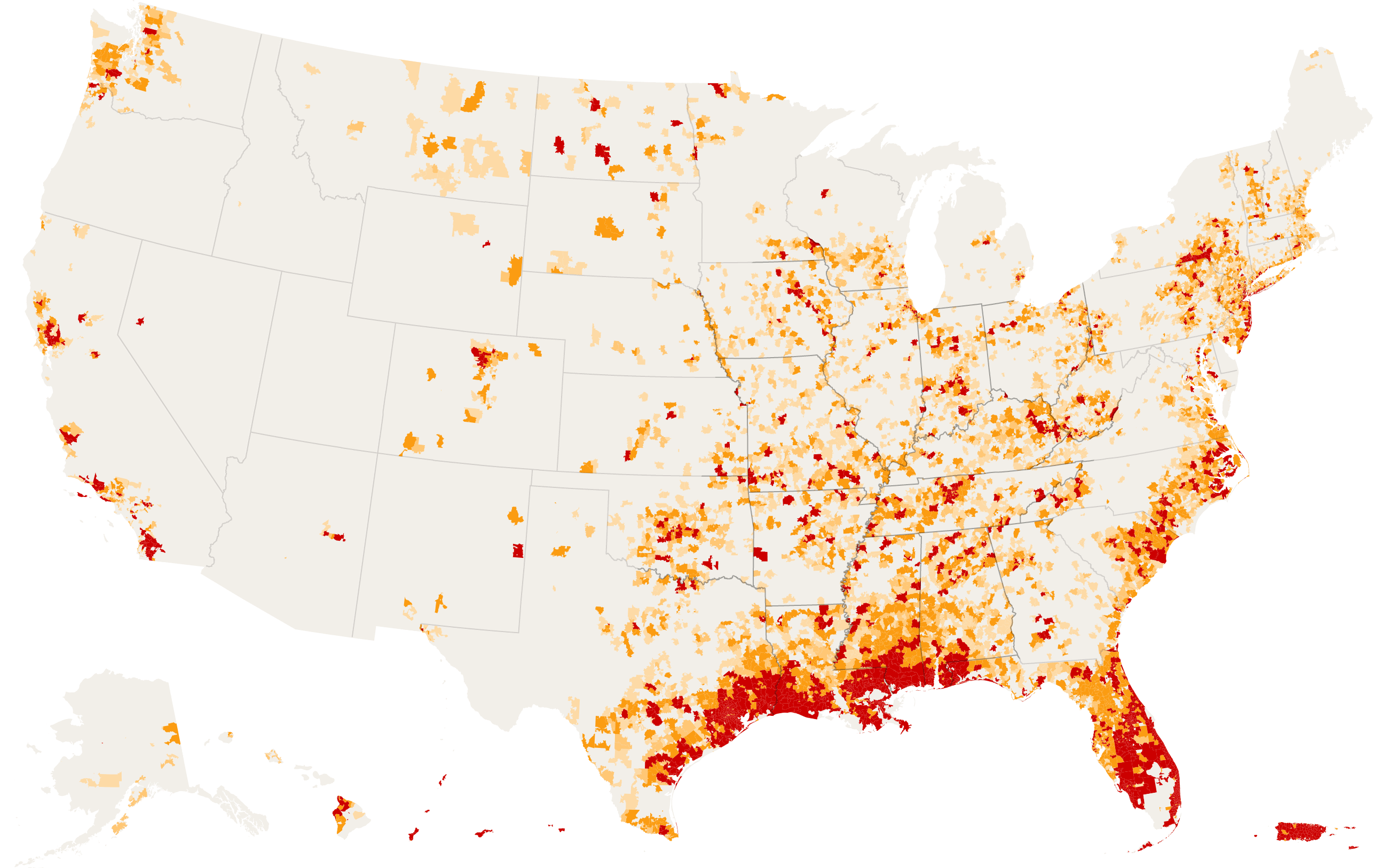
The New York Times published a really interesting story and map of where repeated disasters have occurred across the US from 2002 to 2017, as measured by zip codes where federal disaster assistance has been provided. You can read the story here. One of the things that I find interesting and puzzling about the map is Georgia’s relatively few occurrences compared to surrounding states. They certainly get hit by tropical storms and floods that can be very costly. They also have been hard-hit by droughts since 2002, but I am these do not seem to be depicted in this map. Why is Georgia so low compared to Alabama? Are they being overlooked? Or is the damage from floods and tropical systems just not big enough to warrant federal assistance? I don’t have an answer, but if I find out more I will share it here.