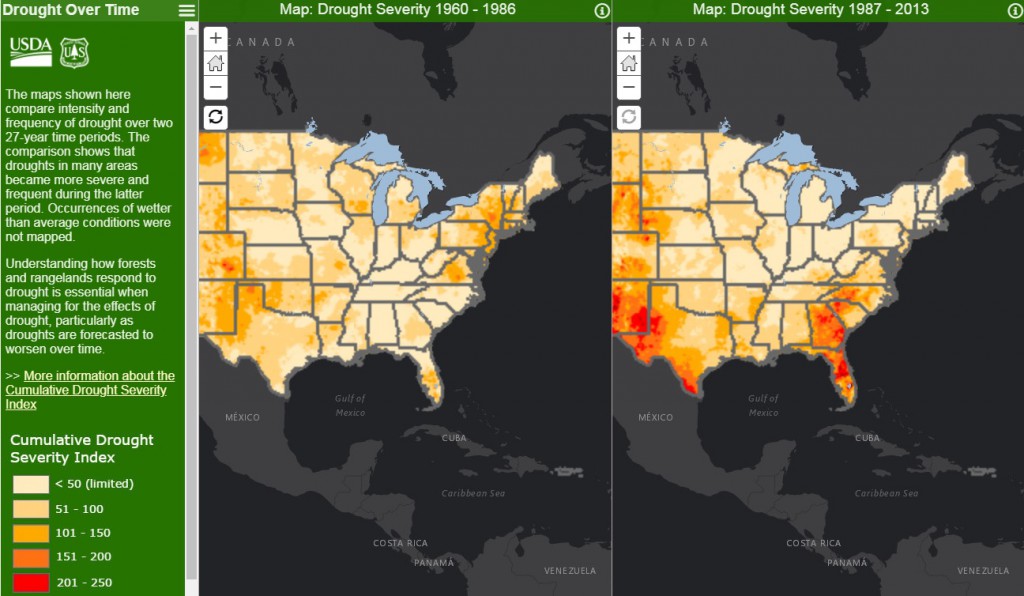
The US Forest Service has produced a series of apps and fact sheets relating climate trends to agriculture and forestry in the US. Here is one app which compared drought frequency in the US between two time periods, one from 1960 to 1986 and the other from 1987 to 2013. As you might expect if you have lived in the Southeast for a while, our region has experienced a lot more drought in recent years than in the previous period, which was characterized by fairly reliable rainfall and much cooler temperatures overall. You can see the interactive comparison map at https://usfs.maps.arcgis.com/apps/CompareAnalysis/index.html?appid=62a006fa8a9241438097f76954d1732d. Note that one shortcoming of this map is that it does not include the drought periods of the 1930s or the bad drought of the mid-1950s.