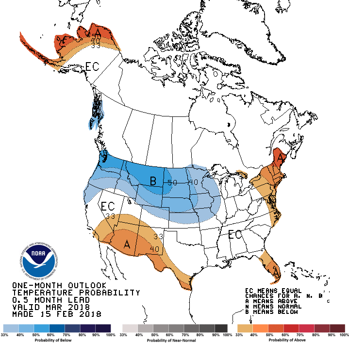
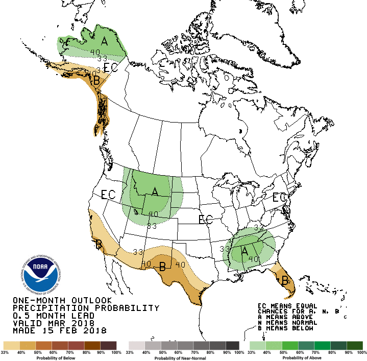
The latest climate outlook maps for the US have been released today. They show that the La Niña pattern we have seen in the last few weeks is expected to continue, although the subtropical jet stream which brings rain to the Ohio River Valley in La Niña years is shifted a bit farther south, as we often see in weak La Niñas. This means that the Florida peninsula is the most likely part of the Southeast to see warmer and drier conditions than normal, while above normal precipitation could be seen in northern parts of Georgia and Alabama where the jet stream is located.
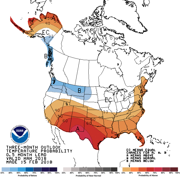
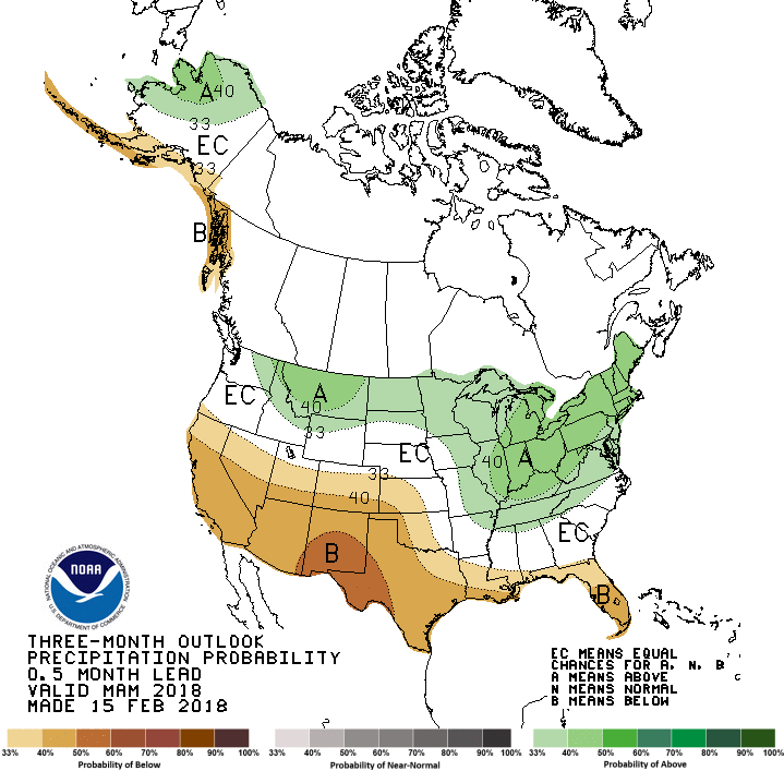
The warm and dry conditions will be particularly bad for the American Southwest, where drought is already well established and is expected to get worse over the next few months.
Above normal temperatures later in the spring could allow farmers to plant earlier than usual, especially in areas with adequate soil moisture, and could also speed up the bloom of fruit trees that have had plenty of chill hours this winter. This could be a problem if another cold outbreak moves through the South. I don’t see anything worrisome in the next two weeks but in early March I expect it to get colder again, although that doesn’t necessarily mean a freeze. Still too early to tell, since that is more than two weeks out.