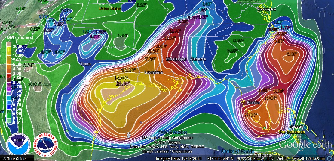
During the day TS Harvey became a hurricane and is expected to continue to strengthen during the next day. It has the potential to hit the Texas coast as a major hurricane with winds of 125 mph or higher. The wind will cause significant problems for coastal residents, but many more residents will be affected by the tremendous rains that are likely to come from the storm. This will be made worse by Harvey’s extremely slow movement through the area, which may cause rainfall of up to three FEET in isolated spots before the storm finally moves on out to the northeast by mid-week. Since the ground is already saturated there, flooding will be widespread. Millions of lives are at stake, and power outages could last for weeks in some areas. This disaster could be far worse than Hurricane Katrina in infrastructure costs, although it may not be as deadly as Katrina was. Dr. Marshall Shepherd of UGA has an interesting article in Forbes.com which describes some of the perils of the storm here.
A second area of heavy rainfall can be seen in southern Florida where a weak collection of thunderstorms called Investigation 92L is slowly moving through the area and off to the northeast, where it may spin up over the warm Gulf Stream waters into a tropical storm.
In between the two rainmakers, parts of Georgia and South Carolina are expected to be mostly dry for the next week under a small ridge of high pressure. Grape farmers in northern Georgia are busy harvesting grapes for white wines this week and hope the fine weather continues there while the harvest is underway. It’s too early to determine whether the remains of Harvey will drift over their area, but they have a few days to see how the storm moves before it is likely to be an issue.