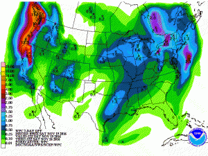
The front passing through the Southeast this morning is dry and is bringing gusty winds to the area, increasing the potential for runaway fires and spreading the smoke from fires north of us back into the area. The next five days should be quite dry, but as we get to the end of next week the models are starting to show that the next frontal passage may bring us some badly needed moisture.
The latest 7 day QPF map shows that small amounts of rain will fall by next Friday night with the next front, but if you look a little farther out you can see more fronts with heavier rain lined up to pass over us in the next couple of weeks. Of course, models can change quite a bit once you get beyond a week, but I am hopeful that the promised change in the pattern is starting to occur and that we will get some relief from the dry conditions soon.
