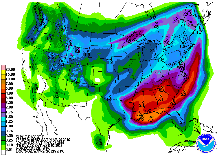
The 7-day QPF map shows that much of the Southeast will receive several inches of rain in the next week, making it much above normal in precipitation. The exception is the Florida peninsula, which should remain fairly dry. The cause is a very slow-moving front which is draped across northern Florida now and which will move very slowly north over the next few days.
A little further out, the long-range models are hinting that we may see a return to colder conditions in the first week of April. There is a potential for freezing temperatures all the way south to Macon (note: later models hold the cold air to the north, which could be a relief for farmers). So think twice before you plant those tender seedlings this weekend; cold conditions are not quite over yet! This could be a problem for fruit farmers, who just missed getting nipped in a cold outbreak last week, but it is still a long ways out in the forecast, so for now it just bears watching.