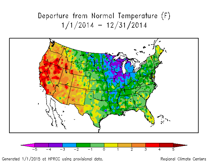
Reports from weather observers are still coming in for the end of 2014, but there are some preliminary results for 2014. The temperatures across the Southeast were generally near to below normal for the year, but fairly mild compared to the region of very cold temperatures in the Great Lakes and the hot conditions in drought-stricken California. This shows the persistence of the pattern which controlled the climate in the US for most of the year, with a ridge of high pressure on the West Coast and a trough of low pressure in the East.
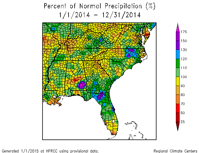
For precipitation, two maps show slightly different yearly departures. The one on the left, from the High Plains Regional Climate Center, shows the estimated departures using station data, while the map on the right shows the precip departures estimated from radar coverage (water.weather.gov/precip). Generally the station data are considered more accurate at the locations of the stations, but radar gives better areal coverage in places where there are no stations. Note the general agreement in the two maps showing wet conditions in southern Georgia and northern Florida, with dry conditions in central Alabama and northern Georgia. The similar patterns continue into the Carolinas.