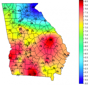
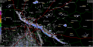
Early this week will have a variety of interesting weather events across Georgia and the Southeast. Today a “wedge” of cool air moved into northeast Georgia, dropping temperatures northeast of Atlanta. You can see the results of the cold air flow in the temperature map from the Georgia Weather Network below as well as a subtle signal in the radar image as well. The main line of the next system is expected to move into Georgia late evening on Monday and could bring severe weather into the state in the early hours of Tuesday morning. The strength of the storms will depend on the speed of the front, the timing of the storm passage (nighttime storms have less solar energy input and so tend to be a little weaker) and whether the wedge is still present in northern Georgia, which tends to reduce severe thunderstorms by increasing atmospheric stability. Keep track of the evolving conditions using NOAA weather radio, weather apps on your smartphone or television broadcasts from local channels. One of the best apps is ReadyGA from the National Weather Service, available at https://www.ready.ga.gov/mobileapp; another is the Red Cross tornado app. You can read a discussion of the evolving weather situation at https://www.athensgaweather.com/athens-ga-weather-monday-october-13-2014/.
Meanwhile, the tropics have heated up. Hurricane Fay is moving east after hitting Bermuda and should dissipate over colder water. Tropical Storm Gonzalo is located ESE of Puerto Rico but is expected to curve north before it can affect us in the Southeast. Even though neither of these storms is likely to affect us, keep in mind that the tropical season in the Atlantic lasts until November and so you need to keep watching for future development.

