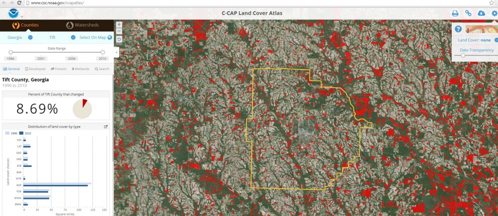
Two new interactive viewers from NOAA’s Coastal Services Center are available online and provide a detailed look at coastal areas across the US. The C-CAP viewer allows you to look at changes in land use from 1996 to 2010 in many areas of the Southeast, although only counties relatively near the coast are included. You can search by county and see the percent chance of various classes of land use to see how they have changed over time. A description of this viewer can be found at https://coast.noaa.gov/digitalcoast/tools/lca. The example below is for Tift County in Georgia.
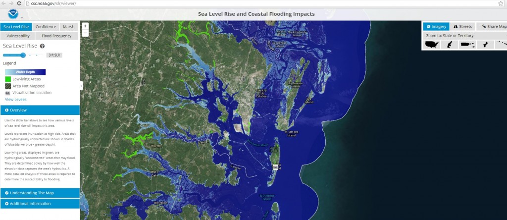
A second viewer shows potential changes due to rising sea levels and could be used to study the coastal vulnerability to storm surges and high tides as well as long-term changes in sea level. You can find this viewer at https://coast.noaa.gov/digitalcoast/tools/slr. The example below shows the inundation that Jekyll and St. Simons Islands in coastal Georgia would experience from a 3 foot rise in sea level.