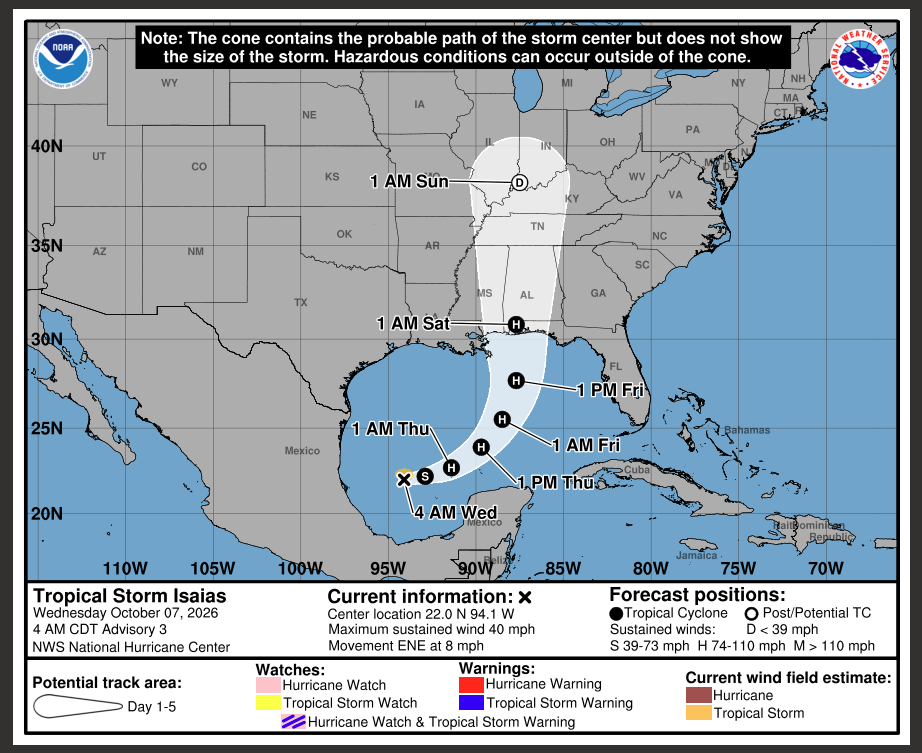
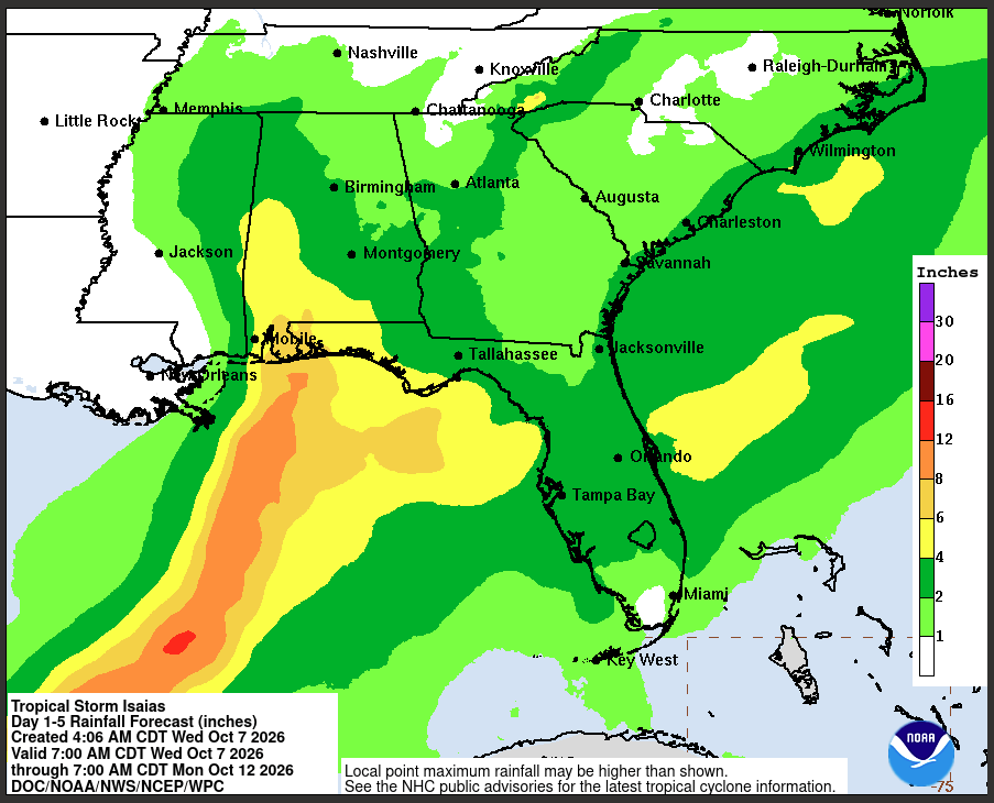
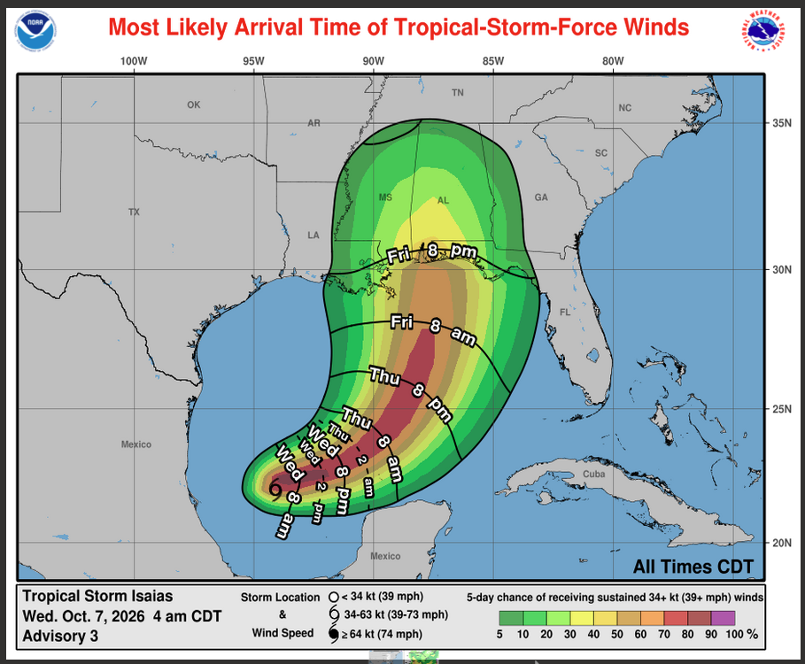
Pam Knox gave us an update on the Isaias situation. Tropical Storm Isaias is headed north towards the Gulf Coast, where it will probably make landfall as a hurricane (possibly a major one) somewhere between Mississippi and the western panhandle of Florida overnight Friday into Saturday. The Gulf is at a record-high temperature, which is contributing to the storm’s rapid strengthening, although it will probably weaken somewhat as it nears land. Even though the storm is unlikely to pass directly over Georgia, we are on the right side of it, which means lots of rain, gusty winds, and the potential for tornadoes, especially in the spiral bands expected to form around the storm. In this case, there is also expected to be some interaction with the large-scale weather pattern, which will make the winds stronger on the east side of the storm, as happened with Hurricane Helene. Impacts of the storm will spread far to the right of the cone, especially in this situation.
For the folks in western Georgia, especially in SW Georgia, you need to prepare for tropical storm force winds occurring as soon as Friday afternoon, although it will most likely be later in the day. Rainfall could start in very southern counties as soon as Thursday night and will spread through the state on Friday as the storm moves north. So take advantage of the nice weather today and Thursday to take care of hurricane preparation, including bringing in anything that could become windborne, moving equipment, animals, and feed out of low-lying areas, and preparing for power outages due to lines and trees down. The storm will be moving through the region on Saturday, which could make the Georgia-Alabama game in Tuscaloosa interesting. Strong winds could occur as far east as the middle of GA if the interaction with the main weather pattern occurs. If you are in eastern Georgia, you can expect some gusty winds, especially in the spiral bands, rain, and the potential for tornadoes, which can occur far away from the storm.
The forecast will continue to evolve over time, so continue to pay attention to information from the National Hurricane Center (https://www.nhc.noaa.gov/) and your local National Weather Service offices. Most commercial weather apps only refresh a couple of times a day so will not necessarily have the most up-to-date information. The forecast for next week looks mostly warm and dry, which might help with harvest once the storm is gone. I will update when I have more information.