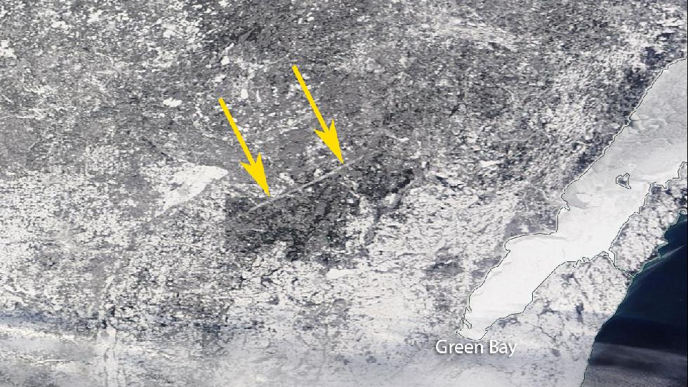
The snow in the upper Midwest last week highlighted several interesting features in the landscape. One of them was a tornado path from an EF3 tornado that traveled along a 40 mile long path through a forested area northwest of Green Bay, Wisconsin in 2007. The Weather Channel has a nice video and write-up of this here. As the article points out, you can see these features in many areas, but the combination of snow and a path through a forested area really brought this path out. There are many similar paths in the Southeast, but since continuous forest cover is infrequent in the Southeast, they are harder to spot.