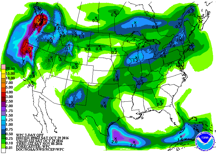
Friends ask me at church and coworkers ask me at work, when is it going to rain? Unfortunately, the answer for today is “probably not this week.” The latest 7-day QPF map shows a very small chance of rain by late next week, but nothing for the next five days as a strong high pressure hangs on over us. There is a chance of some light showers on Thursday or Friday, but since 7-day forecasts can change quite a bit over time the farther out you go, this rain chance could evaporate as well.
Fortunately, if you look a little farther out, the models are indicating a change in the weather pattern on the 10-20 day time scale. It’s pretty typical for us to shift into a more late fall weather pattern around mid-November, so there is some hope of getting cooler weather and some much-needed moisture down the pike, but it may not be soon enough to help farmers trying to get in small grains or a cover crop before frost comes. Meanwhile, this weekend many parts of the Southeast should see temperatures at near record levels before things cool down again. Welcome to the future?