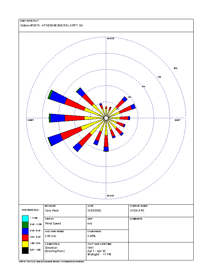
A wind rose is a diagram which shows how frequently wind comes from different directions. It can be used for purposes of planning an event or determining where to place a building. I once used wind rose information for a client in Dodge City, KS to help a casino find the sweetest spot for air quality in the city (keeping in mind that Dodge City is full of cattle feedlots). I’ve even seen them used to determine what orientation to plant rows of trees to minimize damage from the strongest winds. You can learn more about how they are produced from NOAA at https://www.climate.gov/maps-data/dataset/monthly-wind-rose-plots-charts and get access to wind roses near where you live.
The wind rose for Athens GA shows that most wind comes from the west, but there is a significant number of observations from the northeast associated with what we call “wedge” or cold air damming events which bring cool air down the east side of the Appalachian Mountains into our area. The wind rose has north at the top, east on the right, and so on.