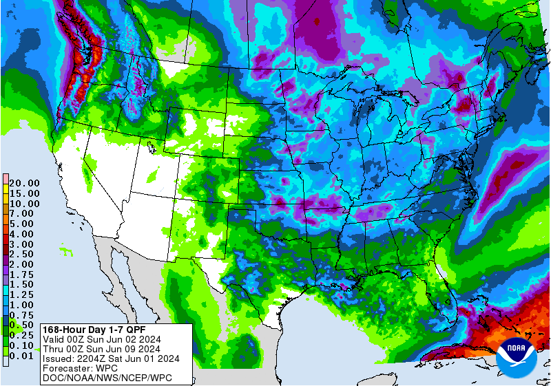
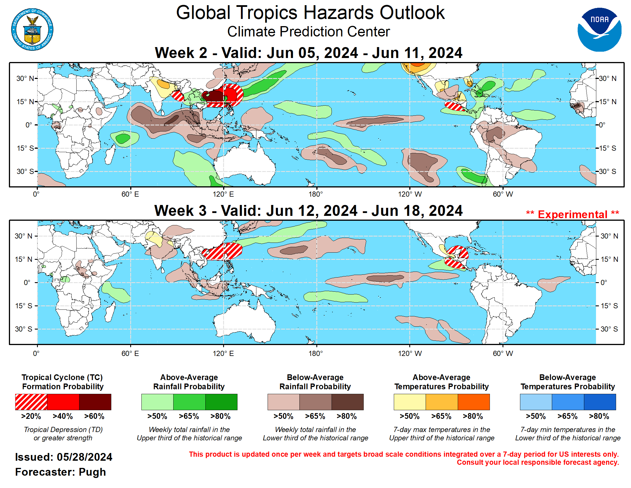
The latest 7-day QPF map shows that most of the region should see their wettest conditions midweek, although amounts will not be large. In South Florida, the rain will be the heaviest over the next three days and showers should taper off later in the week. The area of central Florida with the worst drought is not expected to get much relief from the rain that falls this week. Week 2 is expected to be cooler with close to normal rainfall except in South Florida where the heat will continue. Weeks 3 and 4 are likely to be warmer and wetter than normal across the region. Some of the long-range forecasts are indicating that the chances of tropical development go up in the second half of June, and with the record-setting warm ocean temperatures that will be something to keep track of.