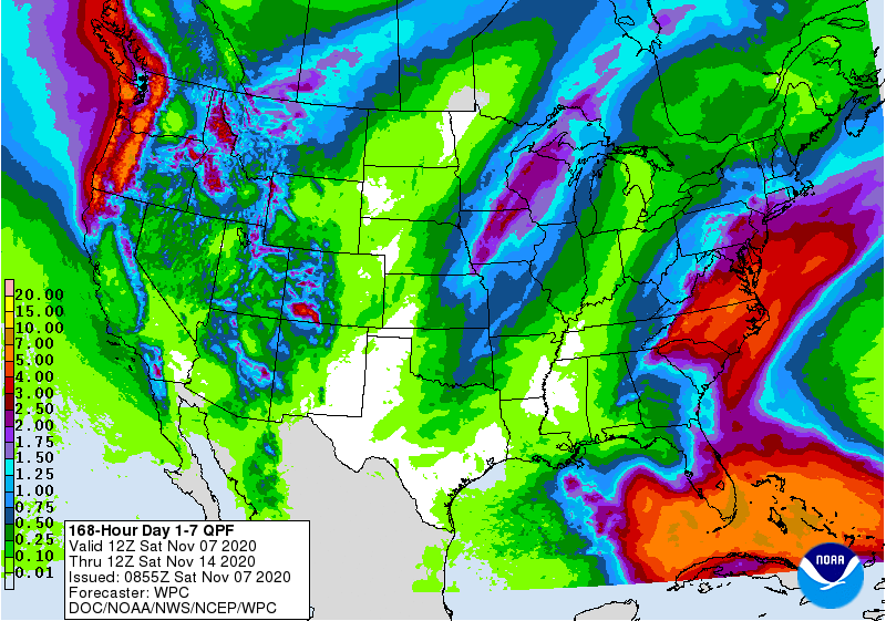
This week’s 7 day QPF map shows that southern Florida and the East Coast will receive the heaviest amounts of rain. That map is dependent on where Eta ends up, so be aware that this could change if the track changes significantly. At the moment, the wettest period for most of the region looks like it will be Tuesday through Thursday from a combination of Eta and frontal rain. Florida will get hit earlier as Eta moves towards them. Above normal temperatures and wetter than usual conditions are expected to occur in week 2, then drier but still warmer than normal conditions are expected in weeks 3 and 4. Because of the current trough in the west and ridge of high pressure in the east, I don’t see any big cold outbreaks coming to our region through mid-November, although there is a hint we could see a change in the pattern by Thanksgiving Week.