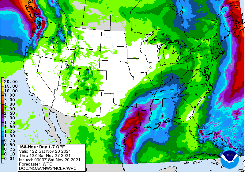
The latest 7-day QPF map shows that there are two weather systems passing through the Southeast this week. The first one will bring some rain to parts of the region starting on Sunday night. By Tuesday, dry and cold weather will return to the area. The next low pressure area starts to move through the region on Thursday night and brings more rain and cold air. Probably not snow though, since the cold air won’t move in until after the precipitation has moved out. This brings a chilly end to the fall season, balancing out the warmer conditions we saw earlier in fall.